• Registration is easy and free!

  • Welcome to the National Parks USA forum! Registered members can download resources for free and use the forum without advertising banners. Click here for free registration. After registration, check your mailbox and confirm your email address.

Capitol Reef National Park | Things to Do & Travel Guide

Capitol Reef National Park
National Park

Capitol Reef National Park

Utah United States

Current park status

8 active alerts
Information

SR 24 Temporary Lane Closures

Read more Show less
UDOT will be repairing small sections of Utah Highway 24 through the park during August 2026. Expect one-lane closures with delays of up to 15 minutes.
Caution

Wildfire Smoke Impacts

Read more Show less
Smoke from nearby wildfires is impacting the park's air quality. Air quality is forecast to be in the unhealthy range for many areas in the park over the next 24 hours. Visitors should consider limiting exertion outdoors. Check Utah Fire Info for wildfire information and the following link for forecasts.
Caution

Monsoon Season & Flash Floods

Read more Show less
Heavy rains can cause sudden flooding, especially in canyons and washes. Do not drive or hike through flood waters. Get to high ground and wait for floods to subside. Some roads may close temporarily; closures are posted at the visitor center.
Information

Stage II Fire Restrictions

Read more Show less
Stage II fire restrictions are in effect until further notice. Campfires including charcoal are not permitted, even in established fire rings. Smoking is only permitted within an enclosed vehicle. Gas or liquid fueled portable camp stoves are still permitted.
Caution

Elevated E. Coli levels - Fremont River

Read more Show less
Recent water quality testing shows elevated E. coli levels in the Fremont River. Use caution if entering the water. Do not get water in your mouth, do not swim. Wash hands with soap and water.
Park Closure

Annual/Seasonal Canyoneering Closures

Read more Show less
The following are closed to entry through 8/31/2026 to protect sensitive resources: the heads of Fivemile Wash & Burro Wash descending east 2 miles; Shinob Canyon + all routes descending into Shinob (including Na-gah, Nighthawk, & Timpie); and Arch Nemesis Canyon, including the route exiting at Capitol Gorge + all direct tributary canyons.
Information

Reef Ride Bike Days 2026

Read more Show less
For this special event in honor of National Public Lands Day, the Scenic Drive will be closed to motor vehicles for part of the day on Saturday, September 19 and Saturday, September 26, 2026. The road will be closed to vehicles from sunrise to 3 pm to allow for bicycles and pedestrians to enjoy the road at a more leisurely pace. The main road through the park (UT highway 24) - will remain open and unaffected by this closure.
Information

Special Use Permits

Read more Show less
Special Use Permits are typically needed for activities that benefit a specific group. Examples include: Groups of 40 or more, trips organized by scouting groups, churches, or academic institutions, photography, weddings, and first amendment activities

Stay Near This Park

Find a place to stay near Capitol Reef National Park.

Compare hotels, cabins, campgrounds, RV parks and vacation rentals.

Search Accommodation
Accommodation search powered by Stay22.

Accommodation Map

Browse nearby accommodations around Capitol Reef National Park.
National Park

Capitol Reef National Park

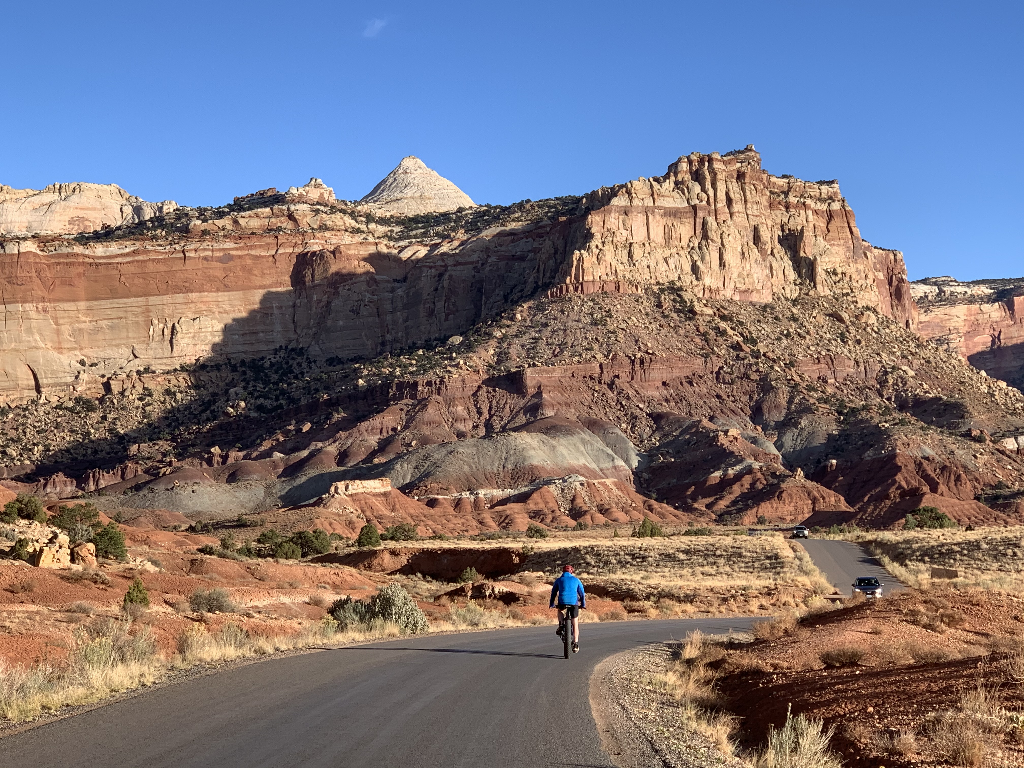
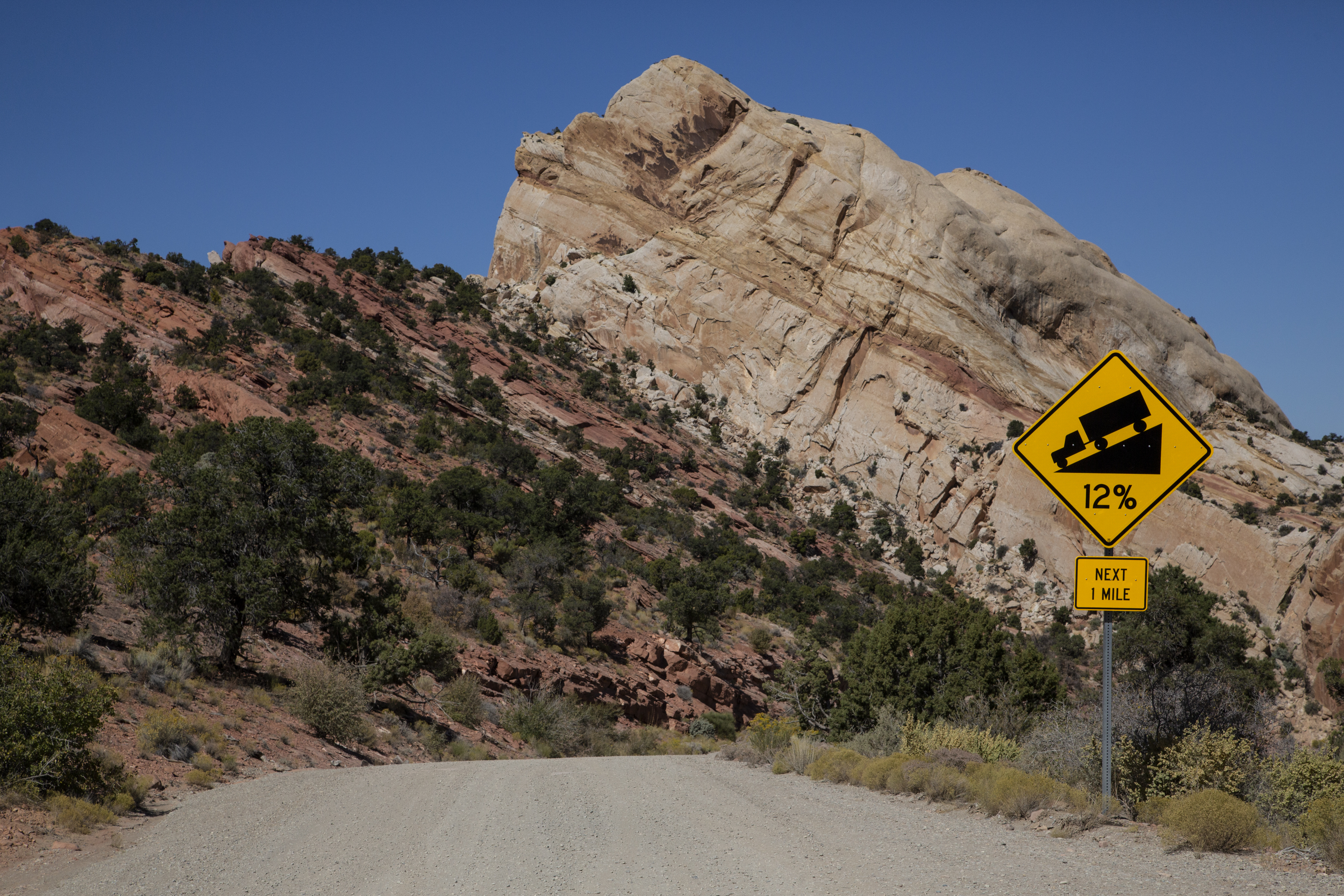
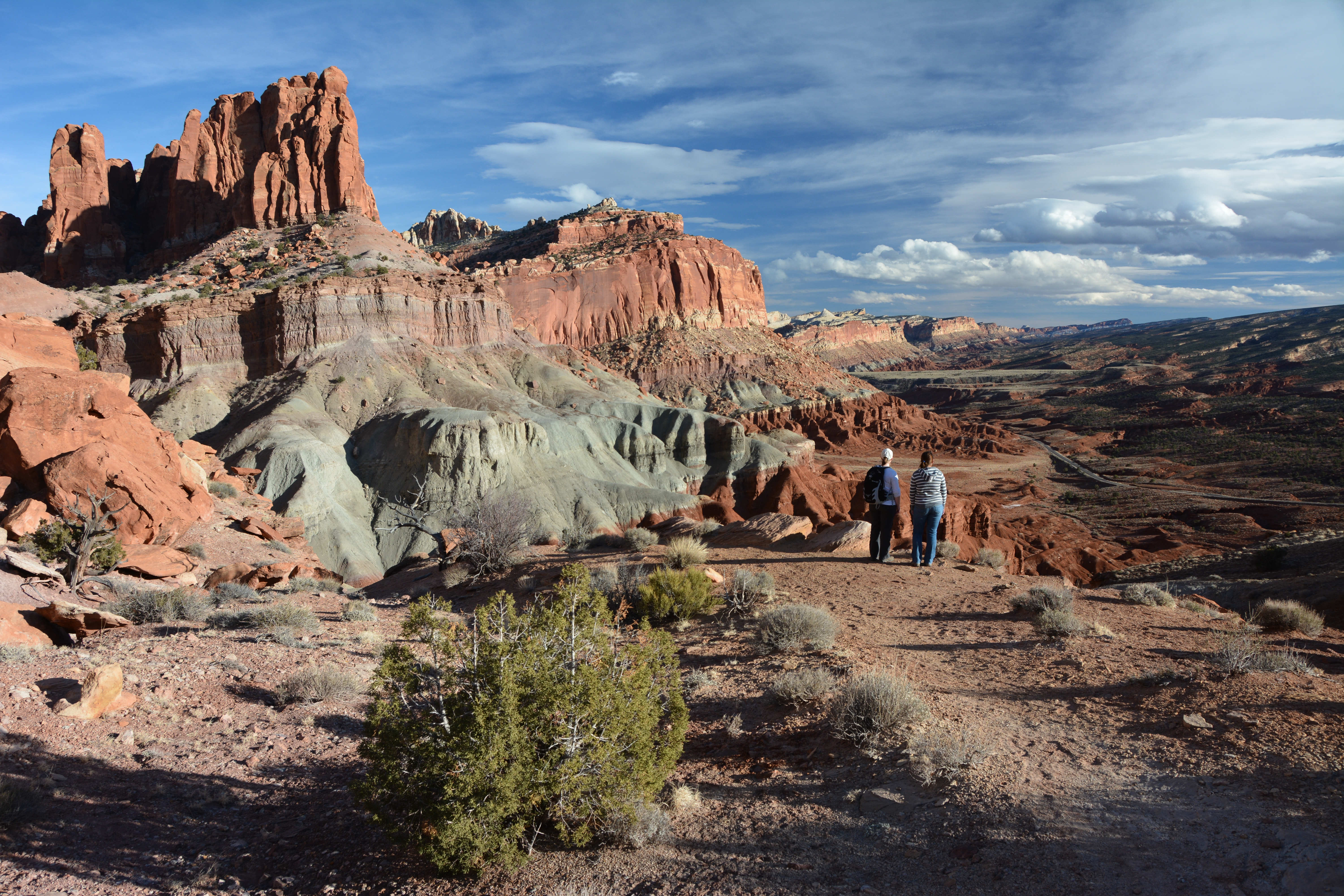
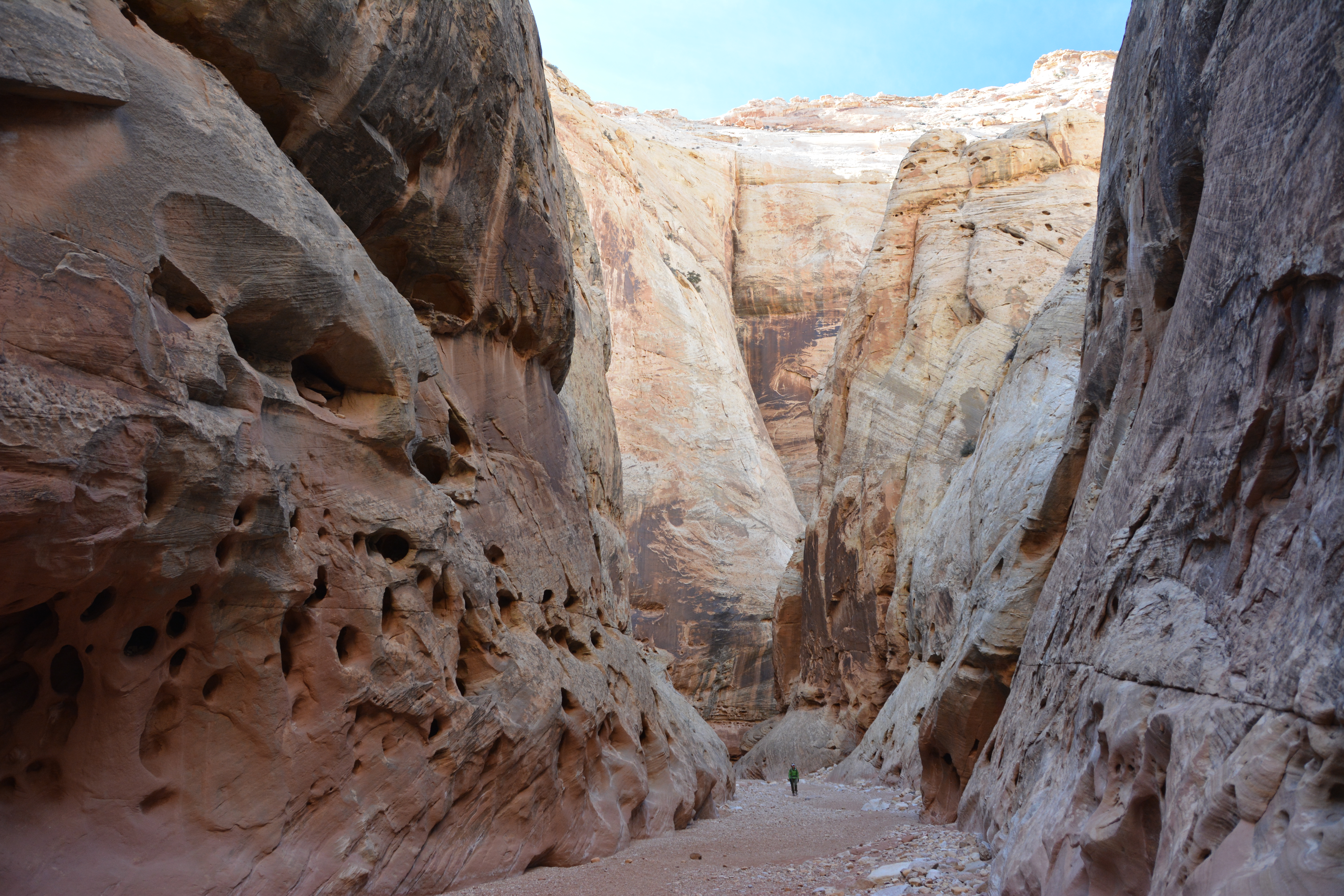
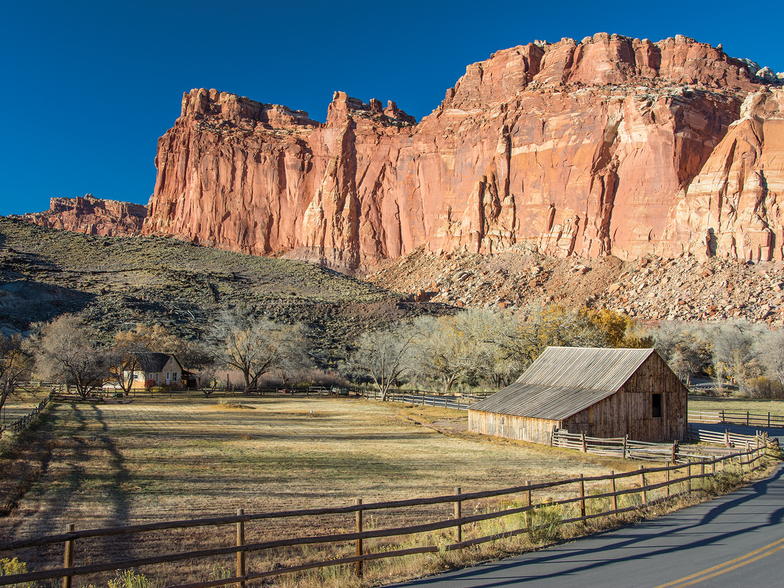
Capitol Reef National Park reveals one of Utah’s most fascinating desert landscapes, where colorful cliffs, sandstone domes, narrow canyons, natural bridges, and rugged mountains stretch along the remarkable Waterpocket Fold. Located in south-central Utah, the park combines classic red-rock scenery with historic orchards, remote wilderness, scenic drives, and outstanding hiking. The Fruita district is the natural starting point for many first-time visitors. Set along the Fremont River beneath towering cliffs, this historic area preserves orchards and reminders of an early farming community in the heart of canyon country. Depending on the season, visitors may even have opportunities to experience the park’s historic fruit-growing tradition. Capitol Reef’s Scenic Drive provides an easy introduction to the surrounding geology. The paved route travels south from Fruita beneath enormous sandstone formations, while side roads lead into Grand Wash and Capitol Gorge. Hiking trails throughout this central area range from shorter walks to longer routes overlooking the Waterpocket Fold. Hickman Bridge, Grand Wash, and trails around Fruita are among the many options for exploring on foot. More adventurous travelers can discover the quieter Waterpocket District in the south or Cathedral Valley in the north. These remote landscapes offer backcountry hiking, dramatic rock formations, unpaved roads, and a much greater sense of isolation. There are many things to do in Capitol Reef beyond hiking. Scenic driving, photography, stargazing, camping, rock climbing, horseback riding, cycling, ranger programs, and backcountry exploration provide different ways to experience the park. Camping is available inside Capitol Reef, while nearby Torrey and surrounding communities provide hotels, cabins, restaurants, and other visitor services. The park also fits naturally into a longer Utah national parks road trip. Whether you spend a few hours exploring Fruita and the Scenic Drive or several days hiking through remote canyon country, Capitol Reef National Park rewards travelers who venture beyond the highway and discover the remarkable landscapes hidden along the Waterpocket Fold.

Things To Do

Explore Things To Do at Capitol Reef National Park

Guided Experiences

Discover guided tours and memorable experiences near Capitol Reef National Park.

Why book a guided experience?

Discover guided tours, tickets and activities available near Capitol Reef National Park.

Flexible cancellation options
Instant confirmation
Convenient mobile tickets
Experienced local guides
Reviews from fellow travelers
Explore Guided Experiences
We may earn a commission when you book through this link.

Weather forecast

Plan your visit with the latest weather forecast for this park.
Weather alerts active
Flood Watch
Today
81°F27°C
Chance Showers And Thunderstorms
WSW 8 mph12 km/h Rain: 52%
Tonight
60°F16°C
Slight Chance Showers And Thunderstorms then Mostly Cloudy
SW 4 mph6 km/h Rain: 14%
Friday
80°F27°C
Mostly Cloudy then Chance Showers And Thunderstorms
SW 5 mph8 km/h Rain: 38%
Friday Night
58°F14°C
Partly Cloudy
WSW 4 mph6 km/h Rain: 8%
Saturday
82°F28°C
Sunny then Slight Chance Showers And Thunderstorms
S 4 mph6 km/h Rain: 10%
Saturday Night
62°F17°C
Partly Cloudy
WSW 3 mph5 km/h Rain: 2%
Forecast data provided by the National Weather Service.
Last updated: Aug 13, 2026 at 11:14 AM
Official forecast
Forecasts can change and local conditions may vary. Check official weather alerts and park guidance before your visit.

More weather details

Today
81°F27°C
Chance Showers And Thunderstorms

A chance of showers and thunderstorms. Partly sunny. High near 81, with temperatures falling to around 76 in the afternoon. West southwest wind 6 to 9 mph. Chance of precipitation is 50%. New rainfall amounts between a tenth and quarter of an inch possible.

WSW 8 mph12 km/h Rain: 52%
Tonight
60°F16°C
Slight Chance Showers And Thunderstorms then Mostly Cloudy

A slight chance of showers and thunderstorms before 9pm. Mostly cloudy. Low around 60, with temperatures rising to around 62 overnight. Southwest wind 1 to 6 mph.

SW 4 mph6 km/h Rain: 14%
Friday
80°F27°C
Mostly Cloudy then Chance Showers And Thunderstorms

A chance of showers and thunderstorms after noon. Mostly cloudy. High near 80, with temperatures falling to around 75 in the afternoon. Southwest wind 2 to 8 mph. Chance of precipitation is 40%.

SW 5 mph8 km/h Rain: 38%
Friday Night
58°F14°C
Partly Cloudy

Partly cloudy, with a low around 58. West southwest wind 1 to 6 mph.

WSW 4 mph6 km/h Rain: 8%
Saturday
82°F28°C
Sunny then Slight Chance Showers And Thunderstorms

A slight chance of showers and thunderstorms after noon. Sunny, with a high near 82. South wind 0 to 7 mph.

S 4 mph6 km/h Rain: 10%
Saturday Night
62°F17°C
Partly Cloudy

Partly cloudy, with a low around 62.

WSW 3 mph5 km/h Rain: 2%
Sunday
84°F29°C
Mostly Sunny then Slight Chance Showers And Thunderstorms

A slight chance of showers and thunderstorms after noon. Mostly sunny, with a high near 84.

W 4 mph6 km/h Rain: 15%
Sunday Night
63°F17°C
Mostly Cloudy

Mostly cloudy, with a low around 63.

WSW 3 mph4 km/h Rain: 5%
Monday
88°F31°C
Mostly Sunny

Mostly sunny, with a high near 88.

SE 5 mph7 km/h Rain: 9%
Monday Night
65°F18°C
Partly Cloudy

Partly cloudy, with a low around 65.

SW 6 mph10 km/h Rain: 7%
Tuesday
90°F32°C
Mostly Sunny

Mostly sunny, with a high near 90.

SSW 7 mph11 km/h Rain: 8%
Tuesday Night
65°F18°C
Partly Cloudy

Partly cloudy, with a low around 65.

SW 8 mph12 km/h Rain: 4%
Wednesday
90°F32°C
Sunny then Slight Chance Showers And Thunderstorms

A slight chance of showers and thunderstorms after noon. Sunny, with a high near 90.

SW 10 mph15 km/h Rain: 12%
Wednesday Night
65°F18°C
Partly Cloudy

Partly cloudy, with a low around 65.

WSW 9 mph14 km/h Rain: 6%

Weather alerts

Flood Watch

Flood Watch issued August 13 at 9:40AM MDT until August 14 at 12:00PM MDT by NWS Salt Lake City UT

* WHAT...Flash flooding caused by excessive rainfall is possible. * WHERE...A portion of Utah, including the following areas, Central Mountains, Eastern Juab/Millard Counties, Bryce Canyon Country, Capitol Reef National Park and Vicinity, South Central Utah, Southern Mountains, Upper Sevier River Valleys, Lower Washington County, Southwest Utah and Zion National Park. This watch includes recent burn scars such as Forsyth, Cottonwood, Widemouth 2, France Canyon, Monroe Canyon, and Silver King. * WHEN...Through Friday morning. This watch may be extended as needed further into Friday night. * IMPACTS...Excessive runoff may result in flooding of rivers, creeks, streams, dry washes, slot canyons, and other low-lying and flood-prone locations such as slickrock areas and recent burn scars. Low-water crossings may be flooded. Area creeks and streams are running high and could flood with more heavy rain. Problematic burn scars, such as the recent Cottonwood burn scar, may see flash flooding this afternoon. Additionally, the recent Widemouth 2 burn scar may result in debris flows near Kanosh, Meadow, and Fillmore this afternoon. * ADDITIONAL DETAILS... - Excessive rainfall from thunderstorms is expected across the threat area today resulting in potential flash flooding across problematic areas, in particular burn scars. - http://www.weather.gov/safety/flood

You should monitor later forecasts and be prepared to take action should Flash Flood Warnings be issued.

Disclaimer

Plan your visit with the latest weather forecast for this park.

Conditions can change quickly and may vary by elevation and location. Check the official forecast and park alerts before you travel.

Forecasts can change and local conditions may vary. Check official weather alerts and park guidance before your visit.

Location and map

View this park in your preferred navigation app for directions and nearby places.

Directions

Capitol Reef National Park is located in south-central Utah, with Utah State Route 24 providing the main paved route through the park. The Capitol Reef Visitor Center is located just off Highway 24 near the historic Fruita district, making it a useful destination for first-time visitors. Torrey is the closest major gateway community and sits west of the park near the junction of Highways 12 and 24. Travelers arriving from Interstate 70 can approach from the east through Hanksville or from the west using connecting highways toward Torrey. Scenic Highway 12 provides an especially memorable approach for travelers combining Capitol Reef with Bryce Canyon and other destinations in southern Utah. The 123-mile highway connects the Torrey area with US 89 while passing through some of Utah’s most dramatic landscapes. Do not rely entirely on GPS navigation when traveling through remote Utah. Use an official map and established highways, particularly when exploring backcountry areas. Once inside the park, paved and unpaved roads lead to different districts, and weather can quickly affect road conditions.

Climate

Capitol Reef National Park has an arid high-desert climate with hot summers, cold winters, low annual rainfall, and large temperature changes between day and night. Elevation also affects conditions throughout the park, particularly between the canyon country and higher terrain. Spring and fall generally offer some of the most comfortable weather for hiking and sightseeing, with mild daytime temperatures and cool nights. Summer is much hotter, with July daytime highs averaging around 91°F near the visitor center. July through September also brings the summer monsoon season. Powerful thunderstorms can produce sudden heavy rain and dangerous flash floods, especially in narrow canyons and washes. Winter is cold, with January highs averaging around 41°F and nighttime temperatures commonly below freezing. Snow and ice can affect roads and trails. For many travelers, spring and fall provide the best balance for hiking and exploring. Regardless of season, check the current forecast and flash-flood risk before entering canyon areas.

Information & Disclaimer

National Parks Explorer strives to present accurate and up-to-date information collected from official and trusted sources, including the National Park Service. While we make every effort to keep this information current, information may be incomplete, inaccurate, outdated or subject to change without prior notice, including access requirements, permits, reservations, operating hours, alerts, fees, road and trail conditions, weather and other visitor information.


Read more Read less

Always verify the latest information with the relevant official source before making travel plans, reservations, purchases or visiting a park.

National Parks Explorer is an independent information platform provided through national-parks-usa.com and is not affiliated with or endorsed by the National Park Service or other data providers. All information is provided for general informational and planning purposes only and is used entirely at your own risk. To the fullest extent permitted by applicable law, National Parks Explorer and national-parks-usa.com cannot be held responsible or liable for any loss, damage, injury, inconvenience, missed reservation, travel disruption, financial loss, additional expense or other costs resulting from the use of, or reliance upon, information provided through this website.

Back
Top