Follow along with the video below to see how to install our site as a web app on your home screen.
Note: This feature may not be available in some browsers.
Registration is easy and free!
Welcome to the National Parks USA forum! Registered members can download resources for free and use the forum without advertising banners. Click here for free registration. After registration, check your mailbox and confirm your email address.
Creek Crossings 3, 4, and 5 Have Deep Water on the Medano Pass Primitive Rd
Read moreShow less
Update 10-16-2026: The third, fourth, and fifth creek crossings on the 4WD Only Medano Pass Primitive Road have deep water crossings. Motorists are advised to use caution and exercise sound judgement to the capabilities of their vehicle. NOTE: Access remains unaffected for all other paved road destinations such as the visitor center, dunes parking lot, and campground.
Flood Watch in Effect for Great Sand Dunes & San Luis Valley Through 10/1
Read moreShow less
The park is expecting up to 2-3 inches of rain in the next 3 days (through Thursday). Please be aware of and prepared for current and changing conditions. Visitors are urged to track National Weather Service Advisories and Alerts on Weather.gov.
WNP Park Store CLOSED on Tuesday September 29, Visitor Center Remains OPEN
Read moreShow less
The Western National Parks Store located in the Great Sand Dunes Visitor Center will be CLOSED on Tuesday September 29th for annual inventory. No store sales will be available in the park that day. Visitors may make purchases that day via the Western National Parks online store. Great Sand Dunes Visitor Center exhibits, restrooms, park film, and ranger information desk remain OPEN 9 am to 4:30 pm on 9-29-2026.
Impassible Section of Medano Pass Primitive Road Due to Muddy Conditions
Read moreShow less
A deep muddy section between the 7th and 8th creek crossing, 9.3 miles northeast of the junction of the main park road of the Medano Pass Primitive Road is causing many vehicles to become mired and stuck. Travel in this area is not advised.
Great Sand Dunes Currently at Stage 1 Fire Restrictions
Read moreShow less
As of August 18th, Great Sand Dunes is under Stage 1 Fire Restrictions. All wood and charcoal fires must be in established fire rings in designated campsites or picnic sites. No other open fires are allowed. Fires MUST BE put out COLD before leaving your site and must not be left unattended. camp stoves and other pressurized gas devices allowed.
Danger
Great Sand Dunes At Stage 2 Fire Restrictions - No Open Fires.
Read moreShow less
As of 12pm on June 29th Great Sand Dunes officially entered stage 2 fire restrictions due to ongoing dry, warm, and windy conditions. During stage 2 fire restrictions the following requirements are in effect: Prohibited: Open flame including fire, campfire, stove fire, charcoal grills and barbeques, coal and wood burning stoves. Smoking outside of an enclosed personal vehicle or trailer. Permitted: Devices using pressurized gas canisters for isobutene or propane that include shut-off valves.
Caution
Speed Limits are Much Lower Inside Park than Surrounding Highways
Read moreShow less
Speed limits for the park include 30 MPH near the park boundary and Great Sand Dunes Sign, and as low as 10 MPH near the Headquarters and Entrance Station. Speed limits are in place to protect park visitors, pedestrians, and wildlife in the park. Please drive carefully and responsibly.
Information
Sand Board and Sand Sled Rentals Not Available In Park.
Read moreShow less
Sand boarding and sand sled rentals are located in local communities surrounding the park. Visitors are encouraged to arrange rentals BEFORE coming to the park.
Piñon Flats Campground, sites can be reserved 3 months in advance for 2026
Read moreShow less
Due to the need for improvements in Piñon Flats Campground, sites can be reserved 3 months in advance beginning in 2026.
About this activity
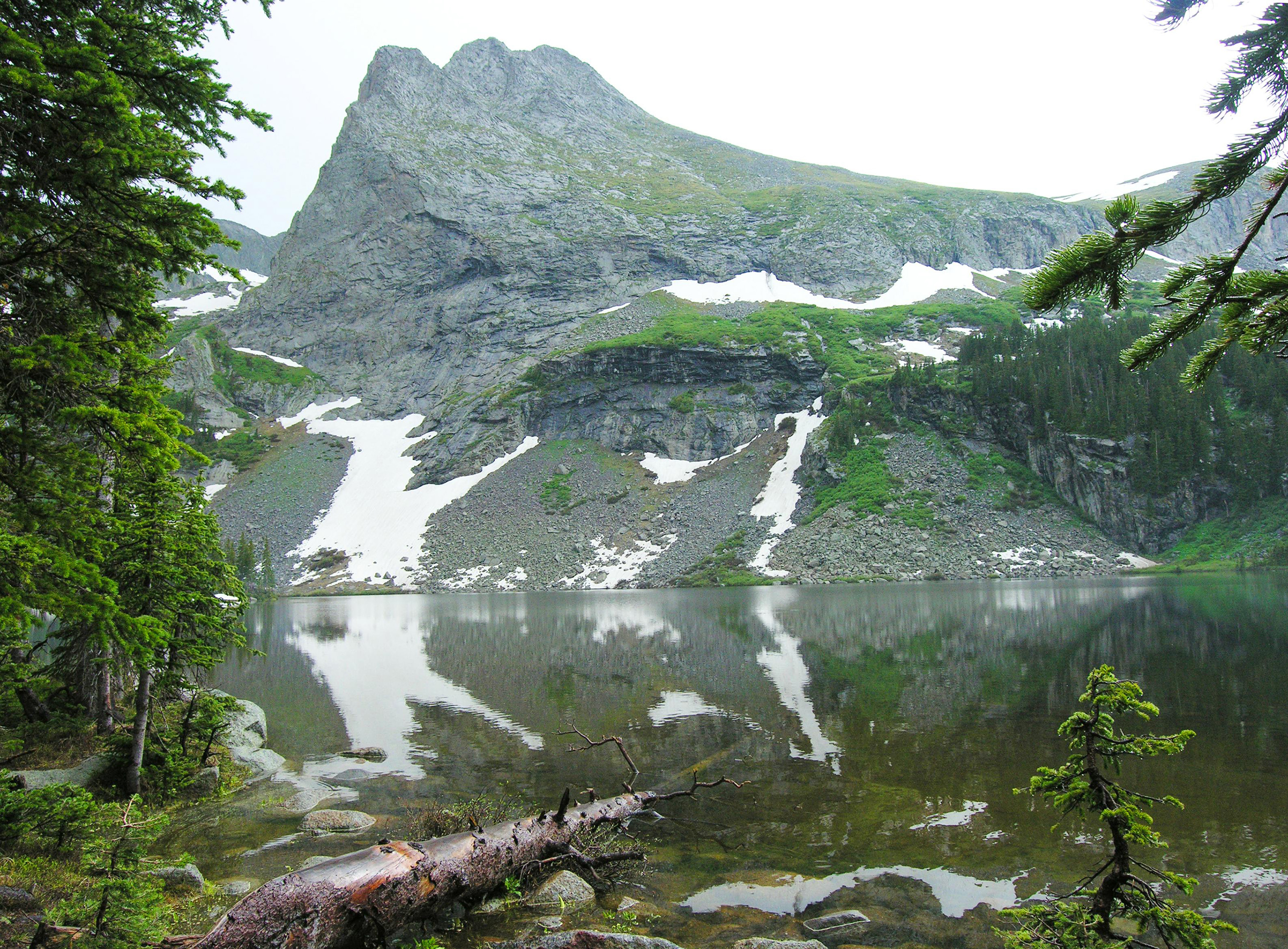
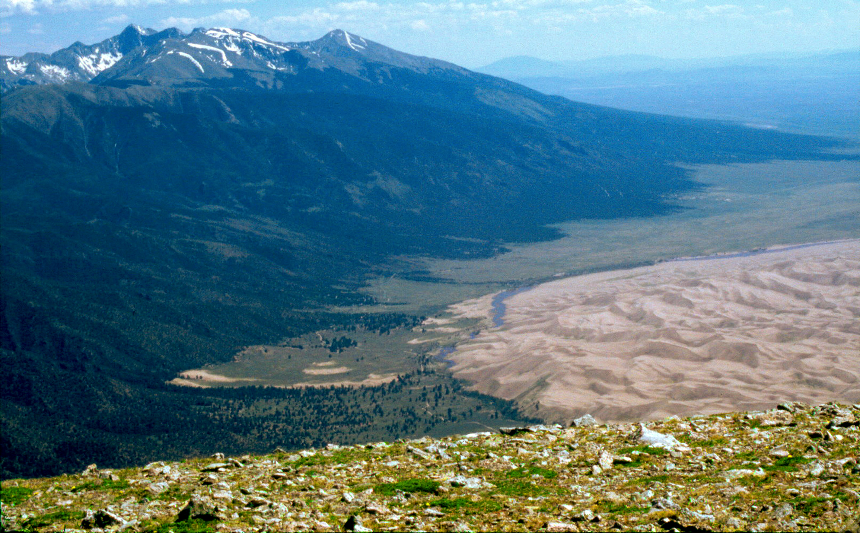
Sand Creek Lakes are part of the alpine watershed of Great Sand Dunes National Preserve. A longer drive and hike is required to reach these lakes, but the mountain scenery is worth the effort. Check with a ranger for conditions before travel. Snow may block these trails from November into June.
Sand Creek Lakes are part of the alpine watershed of Great Sand Dunes National Preserve. A longer drive and hike is required to reach these lakes, but the mountain scenery is worth the effort. Check with a ranger for conditions before travel. Snow may block these trails from November into June.
Music Pass Trailhead is accessed from Highway 69 on the east side of the Sangre de Cristo Mountains, 4.5 miles south of Westcliffe. Turn off Highway 69 to the west at the sign for Music Pass and South Colony Lakes Trailhead. At the "T" junction, turn left onto South Colony Road. At the end of the ranch fence on the right, you'll see another sign for Music Pass.
2WD vehicles should park where the Rainbow Trail crosses Music Pass Road. This lower trailhead will add 2.5 miles (4 km) each way to the hike..
4WD vehicles may continue another 2.5 miles to Music Pass Trailhead at the end of the road. From here, it is a steep 1 mile (1.6 km) hike to the pass at treeline, with a great view of Upper Sand Creek basin. From the pass, hike farther to the alpine lakes, or to any one of the 13,000' peaks above the basin.
Round Trip Hiking Mileages From Music Pass Trailhead
Lower Sand Creek Lake: 8 miles (12.8 km), 2000 feet (610 m) elevation gain Upper Sand Creek Lake: 9 miles (14.4 km), 2000 feet (610 m) elevation gain
Activity details
Location
Lower Sand Creek Lake
Lower Sand Creek Lake is one of the alpine lakes in Great Sand Dunes National Preserve, the watershed of the dunes.
Duration
10-15 Hours
Plan a long day to drive to the trailhead, do the round trip hike at high elevation, and have time for lunch, photos, and exploration.
Age
10-75
Season
Summer, Fall
The area is open year round, but unless you have snowshoes and avalanche gear, plan to access the lakes only in summer or fall. In an average snow year, there are still some snowdrifts on the trail through June. Mid-summer is the prettiest time of year to visit the lakes, when flowers are blooming, grass is green, and snowfields still lace the mountains.
Time of day
Day, Night, Dawn, Dusk
Many people backpack into the lakes, camping at marked sites back away from the lakes. No reservations are needed to camp in Great Sand Dunes National Preserve.
Pets
Yes
Pets are permitted in Great Sand Dunes National Preserve, on leash at all times. Please clean up after your pet.
Fees
No
Accessibility
High clearance 4WD vehicles can make it to Music Pass Trailhead. After that point, the trail is steep and rocky, unsuitable for wheelchairs.
No additional access requirement details are available from the provider.
Official website
Official access information supplied by the provider for this activity. Requirements and availability may change, so always verify the latest details on the official website.
National Parks Explorer strives to present accurate and up-to-date information collected from official and trusted sources, including the National Park Service. While we make every effort to keep this information current, information may be incomplete, inaccurate, outdated or subject to change without prior notice, including access requirements, permits, reservations, operating hours, alerts, fees, road and trail conditions, weather and other visitor information.
Read more
Read less
Always verify the latest information with the relevant official source before making travel plans, reservations, purchases or visiting a park.
National Parks Explorer is an independent information platform provided through national-parks-usa.com and is not affiliated with or endorsed by the National Park Service or other data providers. All information is provided for general informational and planning purposes only and is used entirely at your own risk. To the fullest extent permitted by applicable law, National Parks Explorer and national-parks-usa.com cannot be held responsible or liable for any loss, damage, injury, inconvenience, missed reservation, travel disruption, financial loss, additional expense or other costs resulting from the use of, or reliance upon, information provided through this website.
This site uses cookies to help personalise content, tailor your experience and to keep you logged in if you register.
By continuing to use this site, you are consenting to our use of cookies.