• Registration is easy and free!

  • Welcome to the National Parks USA forum! Registered members can download resources for free and use the forum without advertising banners. Click here for free registration. After registration, check your mailbox and confirm your email address.

Drive Foothills Parkway (Chilhowee to Walland) - Great Smoky Mountains National Park

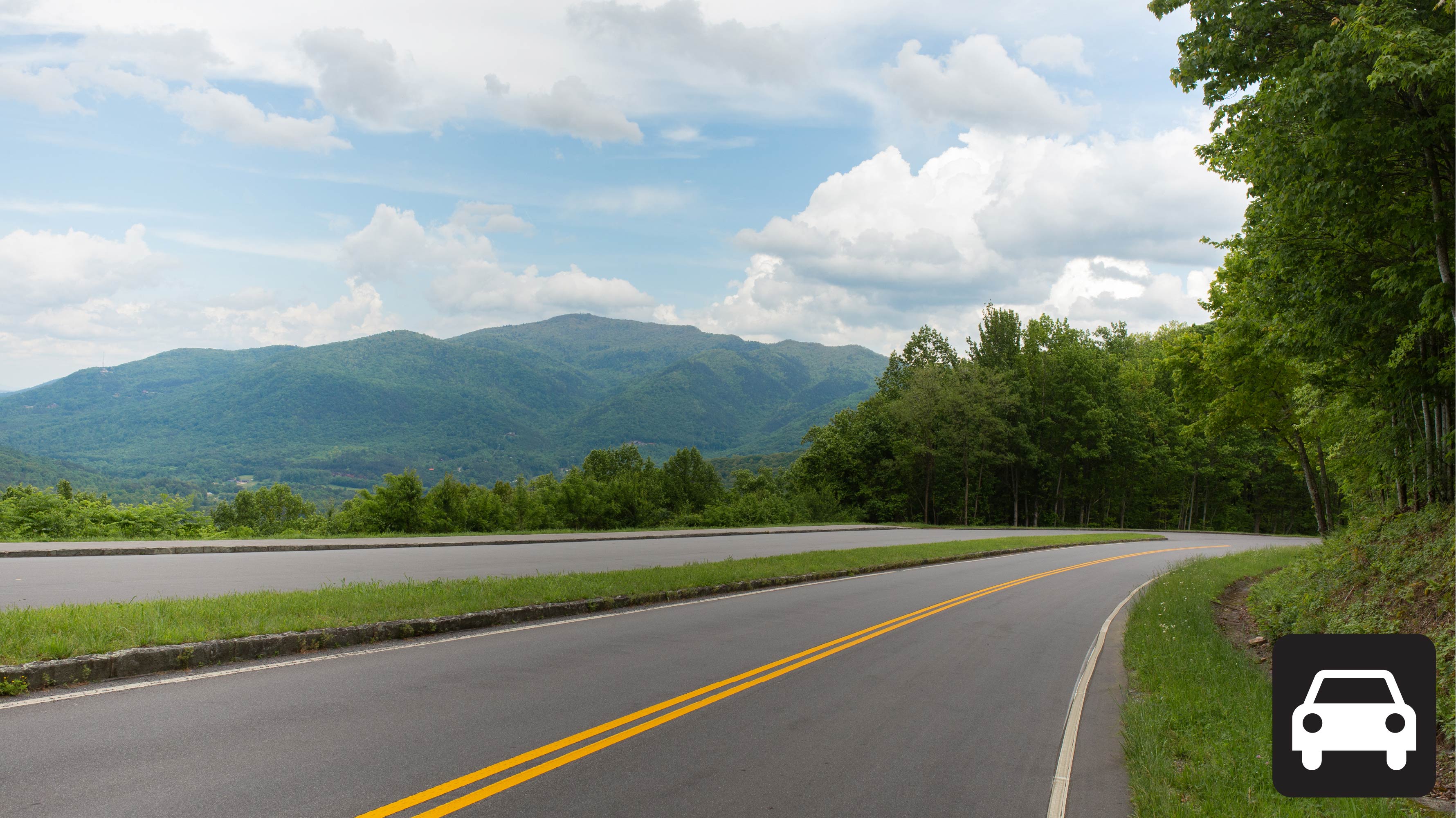
A road through the woods with a sign for Lookrock tower on the right
Scenic Driving

Drive Foothills Parkway (Chilhowee to Walland)

Great Smoky Mountains National Park
Pets: Yes
Fees: Yes

Visitor Dashboard

Current park status

21 active alerts
Park Closure

Balsam Mountain Campground is closed

Read more Show less
Balsam Mountain Campground is closed
Park Closure

US 441/Newfound Gap Road and Balsam Mountain Campground is closed

Read more Show less
US 441/Newfound Gap Road and Balsam Mountain Campground is closed due to wind. U.S. 441/Newfound Gap Road will remain closed for the rest of today, Oct. 10. The road will be reassessed tomorrow.
Park Closure

Abrams Falls Trail Closed on October 8

Read more Show less
Abrams Falls Trail will be closed on Thursday, October 8.
Park Closure

Foothills Parkway West (between Wears Valley and Walland) is closed

Read more Show less
Foothills Parkway West (between Wears Valley and Walland) is closed due to a road maintenance issue.
Park Closure

Upper Tremont Road temporarily closed

Read more Show less
Upper Tremont Road will be temporarily closed from 8 AM to 4 PM due to work along the roadway.
Park Closure

Roaring Fork Motor Nature Trail

Read more Show less
Roaring Fork Motor Nature Trail is temporarily closed for maintenance.
Park Closure

Roadwork on the Gatlinburg Spur to affect traffic

Read more Show less
The park will conduct single-lane closures on the Gatlinburg Spur near Huskey Grove bridge from 7 a.m. to 3:30 p.m. September 21-30. The park plans to start single-lane closures on the southbound lanes and then shift to the northbound lanes. The single-lane closure will affect the tunnel in the northbound lane. Work is scheduled to conclude for the day at noon on Sept. 25 and will not occur over the weekend.
Park Closure

Little River Road between Elkmont and Metcalf Bottoms closed

Read more Show less
The section of Little River Road between Elkmont and Metcalf Bottoms is closed until noon for essential maintenance. Visitors can use Wears Valley Road (US 321) between Townsend and Line Springs Road as a detour. Popular sites including Elkmont, Metcalf Bottoms and Cades Cove will remain accessible during this closure but may require detours. Visitors should plan for increased travel time.
Park Closure

Southbound Spur between Norton Creek & Husky Grove is closed

Read more Show less
The Southbound Spur between Norton Creek & Husky Grove is closed due to a motor vehicle accident. Please find an alternate route.
Park Closure

Kuwohi Road and Observation Tower closed morning of 9/10/2026

Read more Show less
Kuwohi Road will be closed to all pedestrians, cyclists, and motorists the morning of September 10 to facilitate the Kuwohi Connection Days educational programs. The parking area will close at 8 p.m. on September 9, and the road is scheduled to open up at 2 p.m. on September 10. Please consider alternate destinations during this time.
Information

NPS conducting drilling on US441/Newfound Gap Road pullout

Read more Show less
From September 8-17, the scenic pullout north of the Carlos Campbell Overlook on US441/Newfound Gap Road will be closed so that the national park can complete drillwork. The road will not be closed, but please use caution while driving in the area.
Park Closure

Missing person: Have you seen Marcin Bachleda-Blaszczak?

Read more Show less
Bachleda-Blaszczak is described as 5 feet, 6 inches tall and approximately 170 pounds, with brown hair and blue eyes. He is from Illinois. Anyone with information should contact SmokiesTips@nps.gov. You can see his photo and learn more by reading our press release below.
Park Closure

Wear Cove Gap Road closed

Read more Show less
Wear Cove Gap Road is closed between Line Springs and Metcalf Bottoms for bridge repair & road maintenance
Park Closure

Metcalf Bottoms Bridge is closed to pedestrians due to bridge damage

Read more Show less
Metcalf Bottoms Bridge is closed to pedestrians due to bridge damage. Visitors will not be able to walk from the picnic area across the bridge to access the Metcalf Bottoms Trail. Parking for the trail is limited near the trailhead.
Park Closure

Sparks Lane is closed

Read more Show less
Sparks Lane is closed due to high water.
Park Closure

Greenbrier Road is currently closed to downed trees and high water.

Read more Show less
Greenbrier Road is currently closed to downed trees and high water.
Park Closure

Parsons Branch Road is closed

Read more Show less
Parson Branch Road is closed due to high water & downed tree.
Park Closure

Park Headquarters Road is closed

Read more Show less
Park Headquarters Road is closed due to rehabilitation work on the Sugarlands water and wastewater systems.
Information

Cades Cove Loop Road is closed to motor vehicles every Wednesday

Read more Show less
Cades Cove Loop Road is closed to motor vehicles every Wednesday through September 30. This allows pedestrians and cyclists to enjoy the cove without the presence of vehicles on the roadway.
Park Closure

Straight Fork and the one-way section of Balsam Mountain Road closed.

Read more Show less
Straight Fork and the one-way section of Balsam Mountain Road (Heintooga Round-Bottom Road) are closed.
Information

Most visitors need a parking tag

Read more Show less
All vehicles parking for longer than 15 minutes require a parking tag. Three tag durations are available for purchase for all vehicle sizes and types: Daily ($5), Weekly ($15), or Annual ($40).

About this activity

Drive 16.6 miles (26.7 km) one-way on Foothills Parkway from Chilhowee to Walland.

Overview

Drive the section of Foothills Parkway West that connects the community of Walland to the southwest corner of Great Smoky Mountains National Park at Chilhowee Lake. The parkway is popular among individuals seeking to drive US-129 otherwise known as the “Tail of the Dragon” north of Chilhowee Lake. Between Chilhowee Lake and Walland, Tennessee, the parkway has 16 parking areas, 14 of which are scenic overlooks. The parkway climbs the ridge of the foothills over Happy Valley and offers views looking both east towards Great Smoky Mountains National Park and west overlooking Maryville and Alcoa. 

The views available along the parkway vary throughout the drive. Along the southern portion of the parkway, southeastern overlooks face the mountains that surround Cades Cove, providing the opportunity to see the sunrise over one of the most iconic locations of the park. Southeast-facing overlooks along the northern portion of the parkway offer views of working farms in Millers Cove. On clear days, the Cumberland Plateau can be visible from northwest facing overlooks. 

Two improved viewing platforms can be found at Look Rock, 7.1 miles from the southern entrance to the parkway. A set of stairs lead down to the lower platform, directly adjacent to the parking lot. Just north of the parking lot, a short, paved trail leads to the Look Rock Tower.

There are no trash cans available at the parking areas throughout the parkway, so please be sure to pack out your trash.

This section of Foothills Parkway stretches from US-129 by Chilhowee Lake to US-321 near Walland, Tennessee. Mileposts mark the distance from the Chilhowee Lake entrance.

  • Between Mileposts 3 and 4: Two overlooks that face southeast.
  • Between Mileposts 4 and 5: Two overlooks that face southeast.
  • Mile 6.4: One scenic overlook facing southeast.
  • Mile 7.1: Look Rock Tower Trail and lower Look Rock Overlook have ample parking and access to Look Rock Tower.
  • Mile 7.5: Look Rock Picnic Area and Campground provide restrooms and ample parking.Between Mileposts 10 and 11 are two parking areas and one overlook facing northwest.
  • Mile 11.4: Two overlooks on either side of the parkway.Between Mileposts 13 and 14: Two overlooks that face northwest
  • Mile 14.2: Parking area on the southern side of road.Between Mileposts 15 and 16: Two parking areas that face southeast.
  • Mile 16.6: intersection with US HWY 321

Length

16.6 miles (26.7 km) one-way 

Parking 

Parking is available throughout the parkway. Don't forget your parking tag.

Nearest Restroom

Look Rock Picnic Area (available seasonally)

Similar Routes

Activity details

Pets
Yes
Fees
Yes
Accessibility

Guided Experiences

Discover guided tours and memorable experiences near Great Smoky Mountains National Park.

Why book a guided experience?

Discover guided tours, tickets and activities available near Great Smoky Mountains National Park.

Flexible cancellation options
Instant confirmation
Convenient mobile tickets
Experienced local guides
Reviews from fellow travelers
Explore Guided Experiences
We may earn a commission when you book through this link.

Access requirement information

Not available

No additional access requirement details are available from the provider.

Official website

Official access information supplied by the provider for this activity. Requirements and availability may change, so always verify the latest details on the official website.
Visit official website

Weather forecast

Check the weather forecast before planning this activity.
Columbus Day
65°F18°C
Mostly Sunny
N 8 mph12 km/h
Tonight
55°F13°C
Mostly Clear
W 3 mph4 km/h
Tuesday
69°F21°C
Sunny
W 5 mph8 km/h
Tuesday Night
57°F14°C
Clear
S 3 mph4 km/h
Wednesday
72°F22°C
Sunny
SW 3 mph4 km/h
Wednesday Night
59°F15°C
Mostly Clear
S 3 mph4 km/h
Forecast data provided by the National Weather Service.
Last updated: Oct 12, 2026 at 12:06 PM
Official forecast
Forecasts can change and local conditions may vary. Check official weather alerts and park guidance before your visit.

More weather details

Columbus Day
65°F18°C
Mostly Sunny

Mostly sunny, with a high near 65. North wind 5 to 10 mph.

N 8 mph12 km/h
Tonight
55°F13°C
Mostly Clear

Mostly clear, with a low around 55. West wind 0 to 5 mph.

W 3 mph4 km/h
Tuesday
69°F21°C
Sunny

Sunny, with a high near 69. West wind around 5 mph.

W 5 mph8 km/h
Tuesday Night
57°F14°C
Clear

Clear, with a low around 57. South wind 0 to 5 mph.

S 3 mph4 km/h
Wednesday
72°F22°C
Sunny

Sunny, with a high near 72. Southwest wind 0 to 5 mph.

SW 3 mph4 km/h
Wednesday Night
59°F15°C
Mostly Clear

Mostly clear, with a low around 59. South wind 0 to 5 mph.

S 3 mph4 km/h
Thursday
72°F22°C
Sunny

Sunny, with a high near 72. Southwest wind 0 to 5 mph.

SW 3 mph4 km/h Rain: 9%
Thursday Night
59°F15°C
Mostly Clear

Mostly clear, with a low around 59.

SW 3 mph4 km/h Rain: 9%
Friday
65°F18°C
Chance Rain Showers

A chance of rain showers after 8am. Mostly sunny, with a high near 65. Chance of precipitation is 50%.

W 8 mph12 km/h Rain: 51%
Friday Night
38°F3°C
Chance Rain Showers

A chance of rain showers before 2am. Mostly cloudy, with a low around 38. Chance of precipitation is 50%.

N 18 mph28 km/h Rain: 51%
Saturday
47°F8°C
Mostly Sunny

Mostly sunny, with a high near 47.

N 13 mph20 km/h Rain: 12%
Saturday Night
35°F2°C
Mostly Clear

Mostly clear, with a low around 35.

E 8 mph12 km/h Rain: 6%
Sunday
57°F14°C
Sunny

Sunny, with a high near 57.

S 3 mph4 km/h Rain: 6%
Sunday Night
40°F4°C
Mostly Clear

Mostly clear, with a low around 40.

SE 3 mph4 km/h Rain: 5%

Disclaimer

Check the weather forecast before planning this activity.

Weather, wind, precipitation and temperature can vary by location and time. Prepare appropriate clothing and equipment and check official alerts and park guidance.

Forecasts can change and local conditions may vary. Check official weather alerts and park guidance before your visit.

Location and map

View this park in your preferred navigation app for directions and nearby places.

More Things To Do at Great Smoky Mountains National Park

Explore Things To Do at Great Smoky Mountains National Park

Information & Disclaimer

National Parks Explorer strives to present accurate and up-to-date information collected from official and trusted sources, including the National Park Service. While we make every effort to keep this information current, information may be incomplete, inaccurate, outdated or subject to change without prior notice, including access requirements, permits, reservations, operating hours, alerts, fees, road and trail conditions, weather and other visitor information.
Read more Read less

Always verify the latest information with the relevant official source before making travel plans, reservations, purchases or visiting a park.

National Parks Explorer is an independent information platform provided through national-parks-usa.com and is not affiliated with or endorsed by the National Park Service or other data providers. All information is provided for general informational and planning purposes only and is used entirely at your own risk. To the fullest extent permitted by applicable law, National Parks Explorer and national-parks-usa.com cannot be held responsible or liable for any loss, damage, injury, inconvenience, missed reservation, travel disruption, financial loss, additional expense or other costs resulting from the use of, or reliance upon, information provided through this website.

Back
Top