• Registration is easy and free!

  • Welcome to the National Parks USA forum! Registered members can download resources for free and use the forum without advertising banners. Click here for free registration. After registration, check your mailbox and confirm your email address.

A Day In Sunrise - Mount Rainier National Park

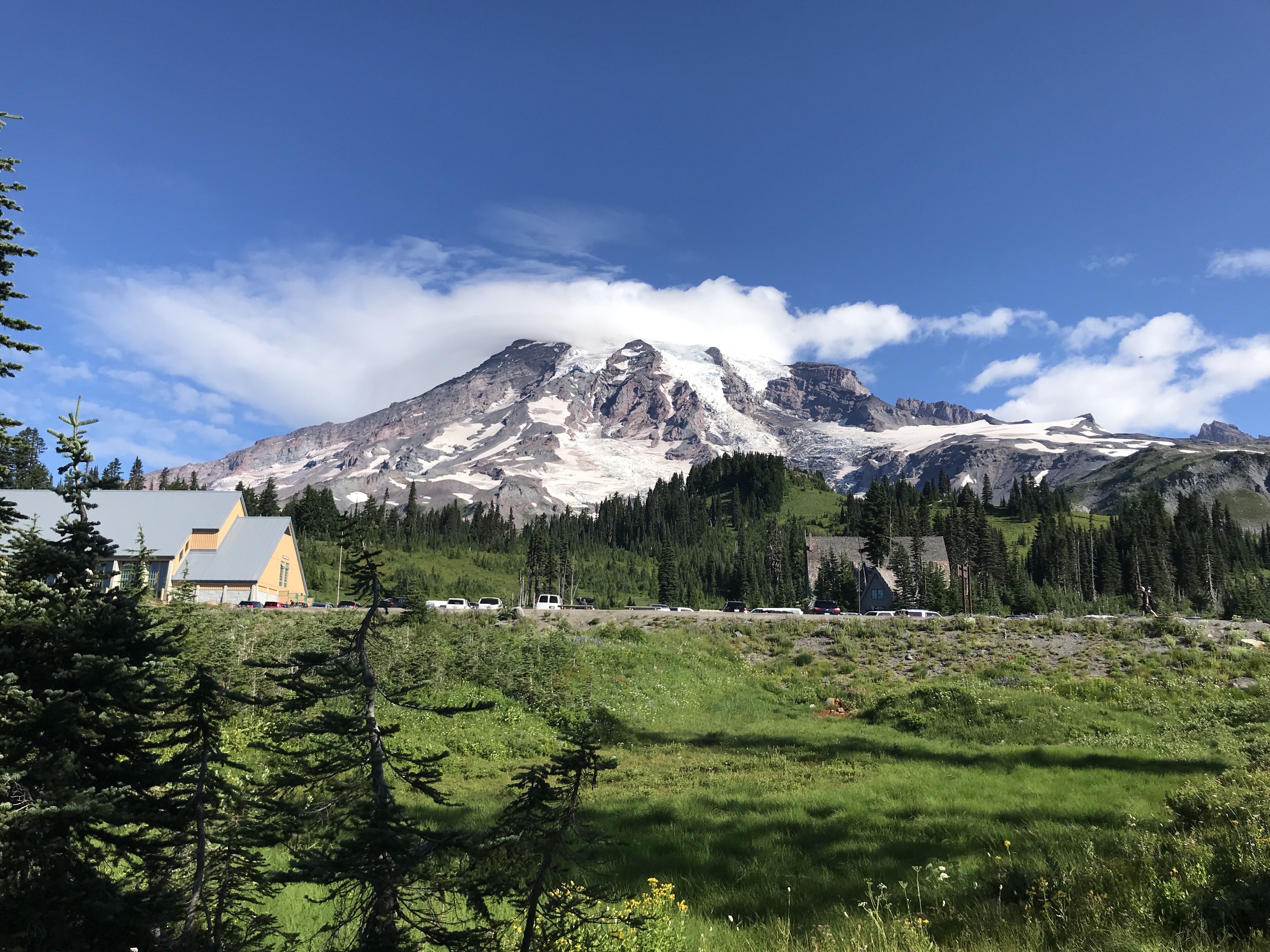
Mount Rainier glows pink and orange as the sun sets. Clouds hang below the summit in an inversion.
Hiking

A Day In Sunrise

Mount Rainier National Park
2-8 Hours
Summer
Pets: No
Fees: Yes

Visitor Dashboard

Current park status

11 active alerts
Danger

WILDFIRE CLOSURES: Sunrise & northern trails. White River open.

Read more Show less
Due to several active fires on the north side of the park, the following closures are in effect until further notice: Grand Park area & trails, Northern Loop Trail, Wonderland Trail from Carbon River Suspension Bridge to Frozen Lake, & associated backcountry campgrounds. White River Road & WR Campground reopened along with White River/Sunrise Trails. Sunrise Rd CLOSED to vehicles; open for pedestrians/bicycling only.
Information

Overnight closure of SR 706 on October 16; no access to Nisqually Entrance.

Read more Show less
SR706 outside of the park will be fully CLOSED overnight from 9 pm Friday 10/16 until 6 am Saturday 10/17, for road repairs to replace a failing culvert. The closure will be from Kernahan Road East to the Nisqually Entrance. There will be NO ACCESS to the Nisqually Entrance during the closure. To reach Paradise during the closure plan to enter the park through the Stevens Canyon Entrance via SR123 on the east side of the park.
Information

Fryingpan Creek Bridge Replacement Project: Traffic and Trail Impacts

Read more Show less
Parking is closed at the Summerland Trailhead on either side of Fryingpan Creek Bridge due to construction through 2029. Access to Summerland remains open via the Wonderland Trail with limited parking at White River Campground. Expect traffic delays of up to 30 minutes due to one-lane traffic on White River Road while it remains open for the season.
Danger

Pinnacle Peak Trail - Plummer Peak Backcountry Area CLOSURE

Read more Show less
8/23/2026 - Due to active wildfire, Pinnacle Peak Trail and the surround area are CLOSED until further notice. This includes the ridge from Lane Peak to Foss Peak across the ridge and from Stevens Canyon Road to the southern park boundary. Stevens Canyon Road is NOT closed.
Caution

Air quality impacted by wildfire smoke.

Read more Show less
Smoke from regional wildfires is affecting air quality in the park. When air quality is a concern: 1. monitor air quality and smoke forecasts; 2. assess your own sensitivity to poor air quality, and the sensitivity of others in your group; 3. adjust outdoor activities as needed.
Caution

Be cautious around park rivers & learn how to cross safely!

Read more Show less
Many hikers underestimate the power of moving water. Regardless of your knowledge, skills, and experience use these pointers in making wise decisions before attempting to cross a river.
Caution

Parkwide Fire Ban in effect until further notice beginning June 26

Read more Show less
Beginning Friday 6/26/26 until rescinded, a parkwide fire ban is implemented for all campfires & the ignition of wood, briquettes, or any fuel in fire pits, fire pans, & BBQ grills.
Information

Your GPS May Be Wrong

Read more Show less
There are five entrances to the park. GPS may take you to the wrong entrance or attempt to follow the most direct route, which could lead to closed gates. It can take hours to reroute to the correct entrance. Check directions & maps, not just your GPS.
Information

Expect long lines at entrances on weekends.

Read more Show less
Lengthy delays are likely at the southwest park entrance on SR706 on weekends. Check Google Maps for backup (represented by the orange/red line) at link below. Please do not block driveways or roads while in line outside the park.
Information

Ohanapecosh Campground area closed for construction in 2026.

Read more Show less
The entire Ohanapecosh Campground area is CLOSED for the duration of the construction project, including all campsites, visitor center, restrooms, picnic area, & Ohanapecosh river access.
Park Closure

SR 165 Carbon River/Fairfax Bridge is closed: no access to Carbon River or Mowich Lake.

Read more Show less
There is NO public access to Carbon River & Mowich Lake from SR 165. The bridge is closed to pedestrians, bicycles and vehicles and there is no alternate route.

About this activity

If you are looking for great views of Mount Rainier, stunning wildflower meadows, interesting history, or a chance to see wildlife, look no further than Sunrise! Use this guide to help plan your day in Sunrise and explore all this part of Mount Rainier National Park has to offer.

Located at an elevation of 6,400 feet, Sunrise is home to the highest visitor center in Mount Rainier National Park and is the highest point that can be reached by vehicle. The Sunrise area is only open for about 3 months each year (early July to late September). In its short season, Sunrise offers stunning views of Mount Rainier, numerous hiking opportunities, wildflower meadows, wildlife viewing, fascinating history, and more! Use this guide to help you decide what to do for your day in Sunrise.

Always check trail and road conditions with a park ranger and online before hiking. Many trails may be partially or entirely covered in snow and can be dangerous. Roads may be closed due to snow conditions. Pet are not allowed on trails.

Don’t Be a Meadow Stomper

  • Don’t step off trail to get a closer look! Stepping off trail can lead to erosion and kill fragile plant life, even in areas that appear to just be soil.

  • Do enjoy the wildflowers from a distance.

  • Don’t pick the wildflowers. Leave them for other visitors to enjoy too!

  • Do take plenty of pictures!

  • Don’t hike on social trails. These are trails created by hikers who strayed away from designated trails. These trails once had alpine and subalpine vegetation growing on them but have been stomped away by lots of foot traffic.

  • Do enjoy the trails while staying safe. Make sure to wear proper clothing and footwear and pack extra food and water.

  • Don’t feed the wildlife. Keep wildlife wild!

Mountain Views

Open seasonally, typically early July to late September. Weather dependent.
Mount Rainier can be seen from many locations in Sunrise. You can see the mountain from the parking lot, the observation deck outside the visitor center, and most of the trails when skies are clear. There is no single best spot to view the mountain. The following trails offer wonderful views:

Emmons Vista Overlooks (Easy) (1 mile round trip, 100 feet elevation gain, 30 minutes) - The trailhead is located south of the parking lot. Follow the Sunrise Rim Trail, then head east on the Silver Forest Trail to the two overlooks. From these overlooks, enjoy the spectacular views of Mount Rainier, the Emmons Glacier, and the White River Valley.

Sunrise Nature Trail (Easy) (1.5 miles round-trip, 300 feet elevation gain, 45 minutes) - The trailhead is located at the upper end of the picnic area. This self-guided loop offers stunning views of Mount Rainier and the Cascade Range north of the park.

Silver Forest Trail (Easy) (2 miles round-trip, 150 feet elevation gain, 1 hour) - The trailhead is located south of the parking lot. Follow the Sunrise Rim Trail, then head east on the Silver Forest Trail until you reach the end of the maintained trail. The trail leads to spectacular views of Mount Rainier and the Emmons Glacier from the Emmons Vista Overlooks (0.5 miles one way) and then continues through stunning seasonal wildflower meadows and an old burn area.

Sourdough Ridge Trail East to Dege Peak (Moderate) (4.2 miles, 800 feet elevation gain, 2.5 hours) - The trailhead is located at the upper end of the picnic area on the north side of the parking lot. Follow the nature trail to the right, then head east on the Sourdough Ridge Trail to the Dege Peak spur trail. This trail offers beautiful views of Mount Rainier, Mount Baker, Glacier Peak, the Cascade Range, and Mount Adams when weather permits. From the summit look down into the White River Park, Sunrise Lake, and Clover Lake.

Mount Fremont Lookout Trail (Strenuous) (5.6 miles, 900 feet elevation gain, 3.5 hours) - The trail head is located at the upper end of the picnic area on the north side of the parking lot. Follow the Sourdough Ridge Trail to the junction at Frozen lake, then take the Mount Fremont Trail to the old fire lookout. This trail offers wonderful views of Mount Rainier and the Cascade Range, including Mount Baker and Glacier Peak.

Burroughs Mountain Trail Loop via Sunrise Rim Trail (Strenuous) (5.2 miles, 1000 feet elevation gain, 3.5 hours) - The trailhead is located on the south side of the parking lot. Follow the Sunrise Rim Trail to Shadow Lake, continue to Glacier Overlook and up First Burroughs Mountain. This trail offers spectacular views of Mount Rainier, the Emmons Glacier, and the Winthrop Glacier. Continue up Second Burroughs Mountain (an additional 1.2 miles, 400 feet elevation gain, 1 hour) for more views of the mountain. Return via the Burroughs Mountain trail towards Frozen Lake, then follow the Sourdough Ridge Trail to the parking lot. Caution: Hazardous travel on icy slopes until late in the season!

Lake Views

Open seasonally, typically early July to late September.
Sunrise Point - At the last hairpin turn before reaching the Sunrise Visitor Center parking lot, take in the views of Mount Rainier, Mount Adams, the Cascade Range, and Sunrise Lake.

Sourdough Ridge Trail West to Frozen Lake (Moderate) (3 miles, 500 feet elevation gain, 1.5 hours) - The trailhead is located at the upper end of the picnic area on the north side of the parking lot. Follow the nature trail to the left, then head west on the Sourdough Ridge Trail towards Frozen Lake. Return to Sunrise back along the Sourdough Ridge Trail or via the Wonderland Trail and the old campground Trail. From the trail, enjoy views of the beautifully blue Frozen Lake. Please stay on the trail! Frozen Lake is surrounded by fragile vegetation. Swimming is NOT permitted in Frozen Lake as it serves as a public water supply.

Shadow Lake via Sunrise Rim and Wonderland Trails (Moderate) (3 miles, 500 feet elevation gain, 1.5 hours) - The trailhead is located on the south side of the parking lot. Follow the Sunrise Rim Trail to the Wonderland Trail. Follow signs for Shadow Lake and Sunrise Camp. The trail offers views of the White River Valley and Mount Rainier through seasonal wildflower meadows as it descends to the beautiful lake. Please stay on the trail and do not swim in the lake! Shadow lake is surrounded by fragile vegetation. Swimming is not permitted in Shadow Lake due to the fragile aquatic ecosystem.

Upper Palisades Lake Trail (Strenuous) (7 miles, 1800 feet elevation gain, 5 hours) - The trailhead is located at Sunrise Point. Follow the Palisades Lake Trail past Clover Lake to Upper Palisades Lake. This trail offers views of seasonal wildflowers and multiple lakes. There are no views of Mount Rainier from this trail.

Historic Buildings

Open seasonally, typically early July to late September.
Sunrise Visitor Center – The Sunrise Visitor Center and Day Lodge are part of the National Historic Landmark District. The visitor center is situated amid colorful subalpine meadows with Mount Rainier and Emmons Glacier as a stunning backdrop. This is Mount Rainier’s highest visitor center, located at 6,400 feet elevation. Inside discover exhibits about the geologic history of the park and the flora and fauna you may encounter.

Sunrise Day Lodge – Opened in 1931, this wood shingled rustic lodge with a steeply pitched roof was built by the Rainier National Park Company. The building was intended to be the first wing of a resort hotel. However, the project did not come to complete fruition, leaving just the one wing to service hungry visitors, offer gifts and supplies, and provide lodging to concessionaire employees. There are no overnight guest rooms.

Wildflowers

Mid-July to Early September.

Sunrise Nature Trail (Easy) (1.5 miles round-trip, 300 feet elevation gain, 45 minutes) - The trailhead is located at the upper end of the picnic area. This self-guided loop offers a stunning walk through wildflower meadows with a backdrop of Mount Rainier.

Silver Forest Trail (Easy) (2 miles round-trip, 150 feet elevation gain, 1 hour) - The trailhead is located south of the parking lot. Follow the Sunrise Rim Trail, then head east on the Silver Forest Trail until you reach the end of the maintained trail. The trail travels through colorfully diverse wildflower meadows and overlooks the White River Valley with views of Mount Rainier.

Shadow Lake via Sunrise Rim and Wonderland Trails (Moderate) (3 miles, 500 feet elevation gain, 1.5 hours) - The trailhead is located on the south side of the parking lot. Follow the Sunrise Rim Trail to the Wonderland Trail. The trail meanders through stunning seasonal wildflower meadows as it descends to the beautiful lake. Please stay on the trail and do not swim in the lake! Shadow lake is surrounded by fragile vegetation. Swimming is not permitted in Shadow Lake due to the fragile aquatic ecosystem.

Scenic Drives

Open seasonally, typically early July to late September.
Sunrise Road (40 minutes) - Starting at the White River Entrance, you will first wind through an old growth forest and then ascend into the subalpine zone of Mount Rainier. Enjoy views of Mount Rainier and roadside wildflower on your drive up. Stop at Sunrise Point for additional views of Mount Adams and the North Cascades. Please only park in designated parking areas and stay on designated sidewalks and roadways. Do NOT walk through the meadows.
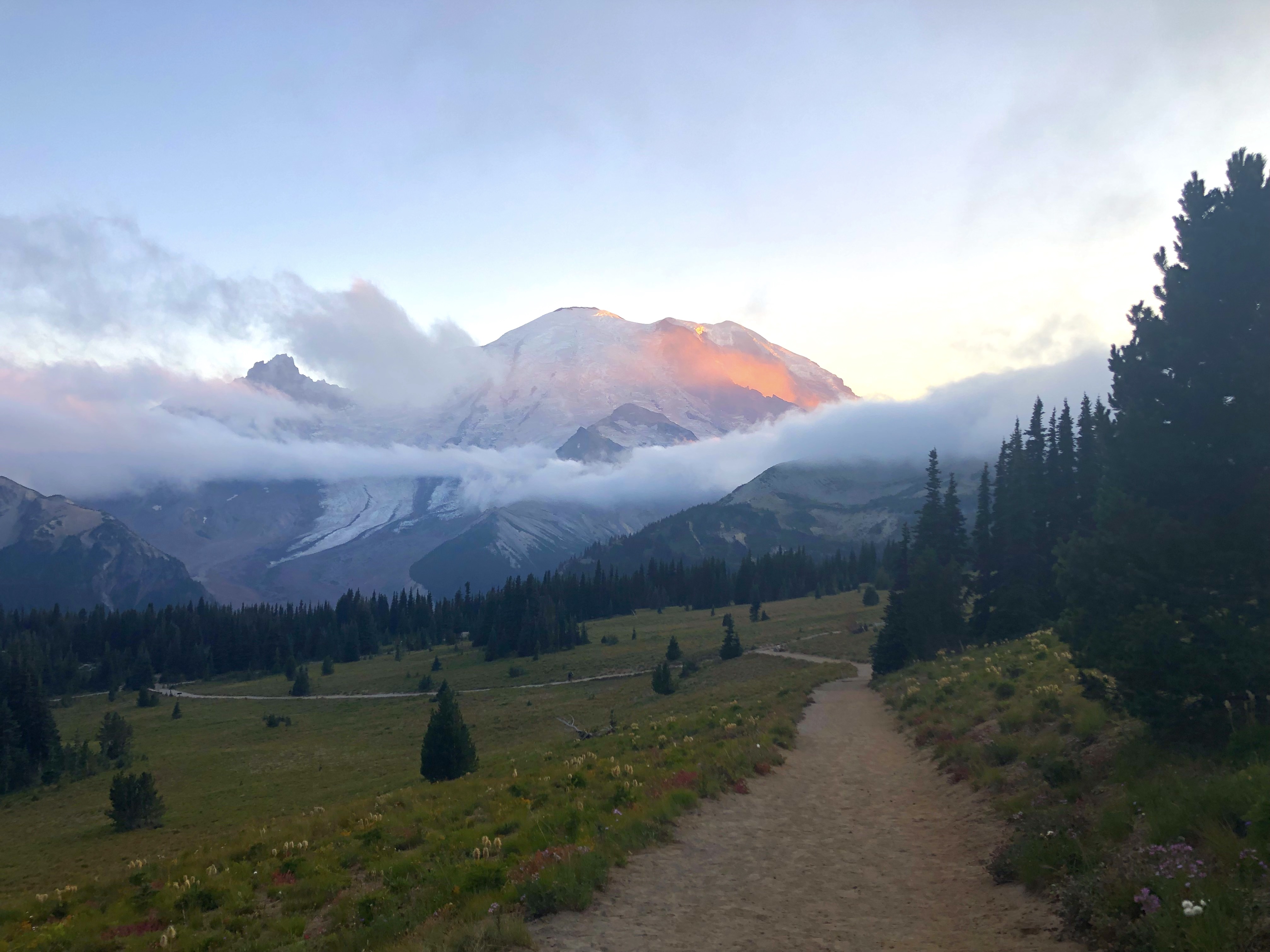
The majority of the activities in Sunrise area require some form of hiking. While there are some viewpoints from the road, this is a very hiking-heavy portion of the park.

Activity details

Location
Sunrise
Duration
2-8 Hours
Age
Not available
Season
Summer
Time of day
Day, Dawn, Dusk
Pets
No
Fees
Yes
Accessibility

Things To Buy

Recommended gear for A Day In Sunrise
We may earn a commission when you book through this link.

Guided Experiences

Discover guided tours and memorable experiences near Mount Rainier National Park.

Why book a guided experience?

Discover guided tours, tickets and activities available near Mount Rainier National Park.

Flexible cancellation options
Instant confirmation
Convenient mobile tickets
Experienced local guides
Reviews from fellow travelers
Explore Guided Experiences
We may earn a commission when you book through this link.

Access requirement information

Not available

No additional access requirement details are available from the provider.

Official website

Official access information supplied by the provider for this activity. Requirements and availability may change, so always verify the latest details on the official website.
Visit official website

Weather forecast

Check the weather forecast before planning this activity.
Tonight
27°F-3°C
Partly Cloudy then Light Snow
WSW 29 mph46 km/h Rain: 75%
Saturday
34°F1°C
Light Snow Likely then Mostly Sunny
W 23 mph37 km/h Rain: 64%
Saturday Night
18°F-8°C
Mostly Clear
WNW 9 mph14 km/h
Sunday
32°F0°C
Partly Sunny
E 7 mph11 km/h
Sunday Night
25°F-4°C
Mostly Cloudy
S 5 mph8 km/h Rain: 1%
Monday
27°F-3°C
Partly Sunny
WSW 5 mph8 km/h Rain: 5%
Forecast data provided by the National Weather Service.
Last updated: Oct 17, 2026 at 1:26 AM
Official forecast
Forecasts can change and local conditions may vary. Check official weather alerts and park guidance before your visit.

More weather details

Tonight
27°F-3°C
Partly Cloudy then Light Snow

Snow after 4am. Partly cloudy. Low around 27, with temperatures rising to around 33 overnight. Wind chill values as low as 18. West southwest wind 20 to 37 mph, with gusts as high as 48 mph. Chance of precipitation is 80%. Little or no snow accumulation expected.

WSW 29 mph46 km/h Rain: 75%
Saturday
34°F1°C
Light Snow Likely then Mostly Sunny

Snow likely before 9am. Mostly sunny. High near 34, with temperatures falling to around 28 in the afternoon. Wind chill values as low as 11. West wind 7 to 39 mph, with gusts as high as 51 mph. Chance of precipitation is 60%. Little or no snow accumulation expected.

W 23 mph37 km/h Rain: 64%
Saturday Night
18°F-8°C
Mostly Clear

Mostly clear. Low around 18, with temperatures rising to around 20 overnight. Wind chill values as low as 7. West northwest wind 5 to 13 mph.

WNW 9 mph14 km/h
Sunday
32°F0°C
Partly Sunny

Partly sunny, with a high near 32. Wind chill values as low as 6. East wind 1 to 13 mph.

E 7 mph11 km/h
Sunday Night
25°F-4°C
Mostly Cloudy

Mostly cloudy, with a low around 25. South wind 1 to 9 mph.

S 5 mph8 km/h Rain: 1%
Monday
27°F-3°C
Partly Sunny

Partly sunny, with a high near 27.

WSW 5 mph8 km/h Rain: 5%
Monday Night
19°F-7°C
Mostly Cloudy

Mostly cloudy, with a low around 19.

NW 5 mph8 km/h Rain: 5%
Tuesday
32°F0°C
Sunny

Sunny, with a high near 32.

N 5 mph7 km/h Rain: 1%
Tuesday Night
24°F-4°C
Mostly Clear

Mostly clear, with a low around 24.

NE 5 mph8 km/h
Wednesday
36°F2°C
Sunny

Sunny, with a high near 36.

ESE 4 mph6 km/h
Wednesday Night
26°F-3°C
Partly Cloudy

Partly cloudy, with a low around 26.

SW 4 mph6 km/h Rain: 11%
Thursday
28°F-2°C
Chance Light Snow

A chance of snow after 11am. Partly sunny, with a high near 28.

WSW 7 mph11 km/h Rain: 43%
Thursday Night
18°F-8°C
Chance Light Snow

A chance of snow. Mostly cloudy, with a low around 18.

W 12 mph19 km/h Rain: 43%
Friday
22°F-6°C
Slight Chance Light Snow

A slight chance of snow. Mostly sunny, with a high near 22.

NW 8 mph13 km/h Rain: 20%

Disclaimer

Check the weather forecast before planning this activity.

Weather, wind, precipitation and temperature can vary by location and time. Prepare appropriate clothing and equipment and check official alerts and park guidance.

Forecasts can change and local conditions may vary. Check official weather alerts and park guidance before your visit.

Location and map

View this park in your preferred navigation app for directions and nearby places.

More Things To Do at Mount Rainier National Park

Explore Things To Do at Mount Rainier National Park

Information & Disclaimer

National Parks Explorer strives to present accurate and up-to-date information collected from official and trusted sources, including the National Park Service. While we make every effort to keep this information current, information may be incomplete, inaccurate, outdated or subject to change without prior notice, including access requirements, permits, reservations, operating hours, alerts, fees, road and trail conditions, weather and other visitor information.

Read more Read less

Always verify the latest information with the relevant official source before making travel plans, reservations, purchases or visiting a park.

National Parks Explorer is an independent information platform provided through national-parks-usa.com and is not affiliated with or endorsed by the National Park Service or other data providers. All information is provided for general informational and planning purposes only and is used entirely at your own risk. To the fullest extent permitted by applicable law, National Parks Explorer and national-parks-usa.com cannot be held responsible or liable for any loss, damage, injury, inconvenience, missed reservation, travel disruption, financial loss, additional expense or other costs resulting from the use of, or reliance upon, information provided through this website.

Back
Top