Follow along with the video below to see how to install our site as a web app on your home screen.
Note: This feature may not be available in some browsers.
Registration is easy and free!
Welcome to the National Parks USA forum! Registered members can download resources for free and use the forum without advertising banners. Click here for free registration. After registration, check your mailbox and confirm your email address.
Temporary Closure of McKittrick Canyon Due to Wildland Fire Activity
Read moreShow less
The McKittrick Canyon section of Guadalupe Mountains National Park will be temporarily closed due to wildland fire activity. This includes all day use areas and the McKittrick Ridge, Wilderness Ridge and Mescalero wilderness campgrounds.
Park Closure
Temporary Closure of Pine Springs Trailhead Parking Lot
Read moreShow less
Starting the evening of Sunday 8/16/26 with an anticipated completion on Saturday 8/22/26, a paving project will be taking place in the Pine Springs area of Guadalupe Mountains National Park. During this closure there will be no parking at the Pine Springs Trailhead. Those that want to hike trails such as Devils Hall or Guadalupe Peak must park at the visitor center and follow a .25-mile path to the trailhead. Wilderness permit holders will also need to park at the visitor center.
Park Closure
Temporary Closure of Pine Springs Trailhead Parking Lot
Read moreShow less
Starting the evening of Sunday 8/10/26 with an anticipated completion on Saturday 8/15/26, a paving project will be taking place in the Pine Springs area of Guadalupe Mountains National Park. During this closure there will be no parking at the Pine Springs Trailhead. Those that want to hike trails such as Devils Hall or Guadalupe Peak must park at the visitor center and follow a .25-mile path to the trailhead. Wilderness permit holders will also need to park at the visitor center.
Information
Park Store To Go Cashless
Read moreShow less
Starting August 14th, 2025 the park store will go cashless. All major credit cards, debit cards and mobile electronic payments will be accepted.
Information
Williams Ranch Road Closed
Read moreShow less
The Williams Ranch Road is currently impassable and closed to public access due to unsafe conditions.
The hike to Devil's Hall is rated as strenuous. The portion of the route in the wash requires rock scrambling and is dangerous when wet or if water is present. The wash surface is loose gravel and rocks and may be unstable.
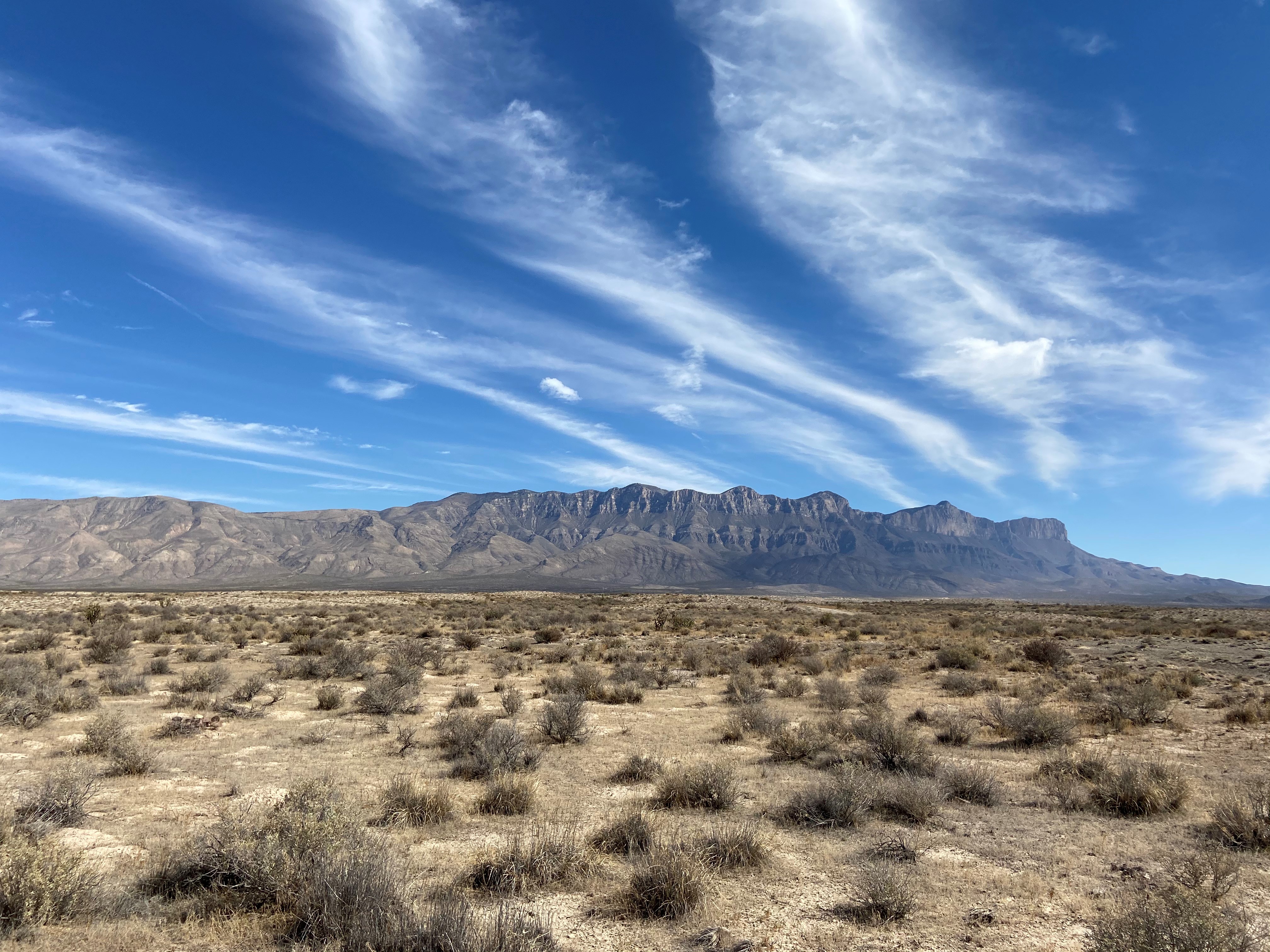
The white gypsum sands of the Salt Basin Dunes rise 100 feet from the desert floor and provide a brilliant contrast to the dark, towering cliffs of the Guadalupe Mountains. This is a lesser used area of the park; a drive to the dunes provides excellent views of El Capitan and the western escarpment of the Guadalupe Mountains.
The white gypsum sands of the Salt Basin Dunes rise 100 feet from the desert floor and provide a brilliant contrast to the dark, towering cliffs of the Guadalupe Mountains. To the west are barren salt flats that are the source of these beautiful dunes. When rain runs off the highly soluble limestone rock in the adjacent mountains, salts are leached. This runoff pools in the desert basin and as it evaporates, large grains of mineral salts are left behind. The wind carries the salt grains northeast toward the Guadalupe Mountains and deposits them at the base of the western Guadalupe escarpment to form gypsum dunes.
The dune landscape is geologically young. It developed over the past few thousand years as dissolved salts and gypsum from an adjacent lake bed were deposited by wind into ever changing sculpted hill, swale, and ripple formations. The mesquite coppice dunes form stabilized spots where wildlife abounds.
The dunes environment is home to gypsum-loving plant and animal life such as gypsum scalebroom, a white variant of the lesser earless spiny lizard, and five of the park’s seven species of scorpions.
Visitors are allowed to hike over the open dunes, but are encouraged to avoid walking on the fragile biological soil crusts. Visitors may also hike on abandoned ranch road traces and discover windmills and other historic remnants of the past. Temperatures in the dunes area are generally mild in the winter and dangerously hot in the summer.
From the Pine Springs Visitor Center, turn right on Highway 62/180 and drive west for 23 miles. At Salt Flat, turn right on FM road 1576. Drive north 17 miles then turn right on Wiiliam's Road. Travel 7.5 miles East to the parking area. From the trailhead, you will still need to hike about 1 mile. Follow the trail that takes you to the dunes.
Pay close attention to your route when leaving the dunes. Following the wrong road will lead you away from your vehicle and further into the desert. The surface of the access road is clay. During rainy weather, the road becomes dangerously slippery; it is unsafe to travel when wet. The speed limit is 25 miles per hour. Watch for livestock on the roadway.
Activity details
Location
Salt Basin Dunes Trailhead
The only entry point to the park on the west side of the Guadalupes, the Salt Basin Dunes trailhead
Duration
2-4 Hours
The drive from Pine Springs to the Salt Basin Dunes can take about an hour under most circumstances.
Season
Spring, Fall, Winter
Visitation to the Salt Basin Dunes can be problematic during the summer months when temperatures can exceed 100°F. Summer storms may produce heavy rains that can make the access road impassable for days or weeks at a time.
Time of day
Day
The Salt Basin Dunes is a day use area open from sunrise to sunset.
Highway 62/180 and some approach roads to the dunes ares paved. Pullouts along the highway will have variable conditions, ranging from dirt to accessible facilities. Accessible parking, picnic areas, and a vault toilet are available at the trailhead parking area. No other accessible facilites are present.
Guided Experiences
Discover guided tours and memorable experiences near Guadalupe Mountains National Park.
Why book a guided experience?
Discover guided tours, tickets and activities available near Guadalupe Mountains National Park.
No additional access requirement details are available from the provider.
Official website
Official access information supplied by the provider for this activity. Requirements and availability may change, so always verify the latest details on the official website.
National Parks Explorer strives to present accurate and up-to-date information collected from official and trusted sources, including the National Park Service. While we make every effort to keep this information current, information may be incomplete, inaccurate, outdated or subject to change without prior notice, including access requirements, permits, reservations, operating hours, alerts, fees, road and trail conditions, weather and other visitor information.
Read more
Read less
Always verify the latest information with the relevant official source before making travel plans, reservations, purchases or visiting a park.
National Parks Explorer is an independent information platform provided through national-parks-usa.com and is not affiliated with or endorsed by the National Park Service or other data providers. All information is provided for general informational and planning purposes only and is used entirely at your own risk. To the fullest extent permitted by applicable law, National Parks Explorer and national-parks-usa.com cannot be held responsible or liable for any loss, damage, injury, inconvenience, missed reservation, travel disruption, financial loss, additional expense or other costs resulting from the use of, or reliance upon, information provided through this website.
This site uses cookies to help personalise content, tailor your experience and to keep you logged in if you register.
By continuing to use this site, you are consenting to our use of cookies.