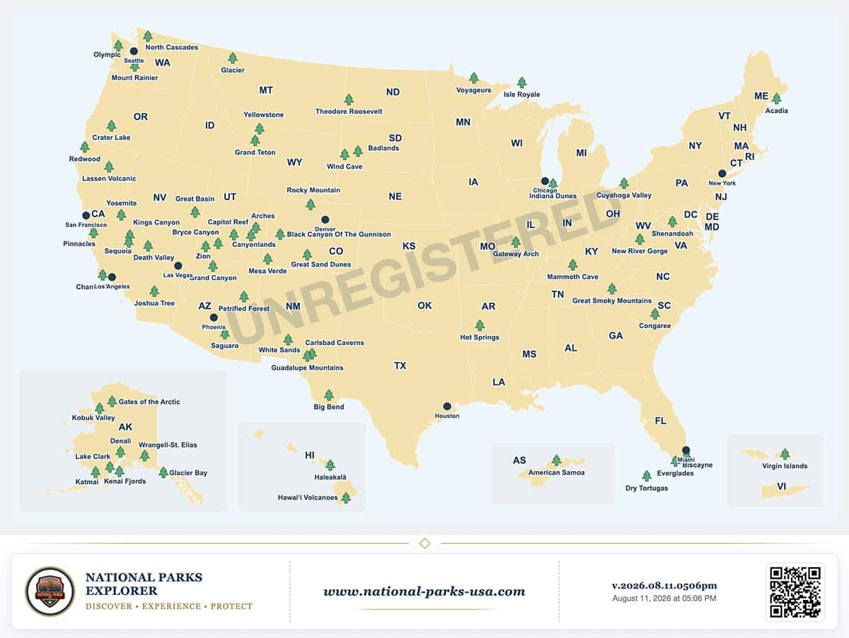
Where should your next national park trip begin? Looking at national parks by state can help you discover possibilities, whether you want to explore several parks in one region or spend more time getting to know a single destination.
The United States has 64 officially designated national parks, including two in U.S. territories. Their distribution offers a useful starting point for exploring the country—but the number of parks is only part of the story.
Contents
- Which states have the most national parks?
- Chiricahua: Arizona’s fourth national park
- A park count is a starting point for your trip
- Remember the national parks in U.S. territories
- Understanding the colors on the map
- Why some parks count in more than one state
- Create a map of your own park travels
- Sources and map notes
Which states have the most national parks?
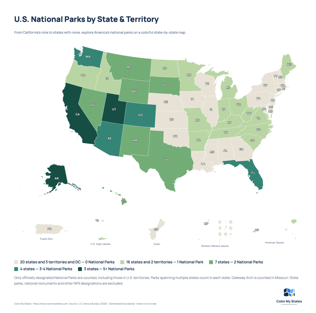
California leads with nine national parks, followed by Alaska with eight and Utah with five. Arizona and Colorado each have four. These seven states have the highest totals:
| State | National parks |
|---|---|
| California | 9 |
| Alaska | 8 |
| Utah | 5 |
| Arizona | 4 |
| Colorado | 4 |
| Florida | 3 |
| Washington | 3 |
Chiricahua: Arizona’s fourth national park
On October 20, 2026, Chiricahua National Monument was redesignated as Chiricahua National Park, becoming America’s 64th national park. Arizona now has four: Chiricahua, Grand Canyon, Petrified Forest and Saguaro.
Located in southeastern Arizona, Chiricahua is known for its volcanic rock spires and balanced rocks. Hiking, wildlife watching and scenic drives offer different ways to explore the landscape. If you are researching an Arizona trip, it adds another national park to consider alongside the state’s canyons, desert scenery and petrified wood.
A park count is a starting point for your trip
A higher total gives you more parks to research, but it does not tell you how much time to spend in each one. Yosemite alone offers waterfalls, granite landscapes, giant sequoias and an extensive wilderness. You could build a trip around different experiences within that single park.
Access matters, too. Alaska’s Gates of the Arctic has no roads or established trails within the park. A visit there requires a very different approach from a trip built around scenic drives and short walks.
Use the numbers to gather ideas, then narrow your choices by the experiences you enjoy. Think about hiking, photography, wildlife, history or time near the water. Allow room in your itinerary to explore the places that interest you most.
Remember the national parks in U.S. territories
A map limited to the 50 states leaves out two national parks:
- National Park of American Samoa: a South Pacific destination where island landscapes, coastal scenery and Samoan cultural heritage are central to the experience.
- Virgin Islands National Park: a Caribbean park on St. John where visitors can explore beaches, coral reefs, hiking trails and historic sites.
These destinations broaden the possibilities beyond a mainland road trip. They also deserve their own research into transport, accommodation and the time needed to explore.
Understanding the colors on the map
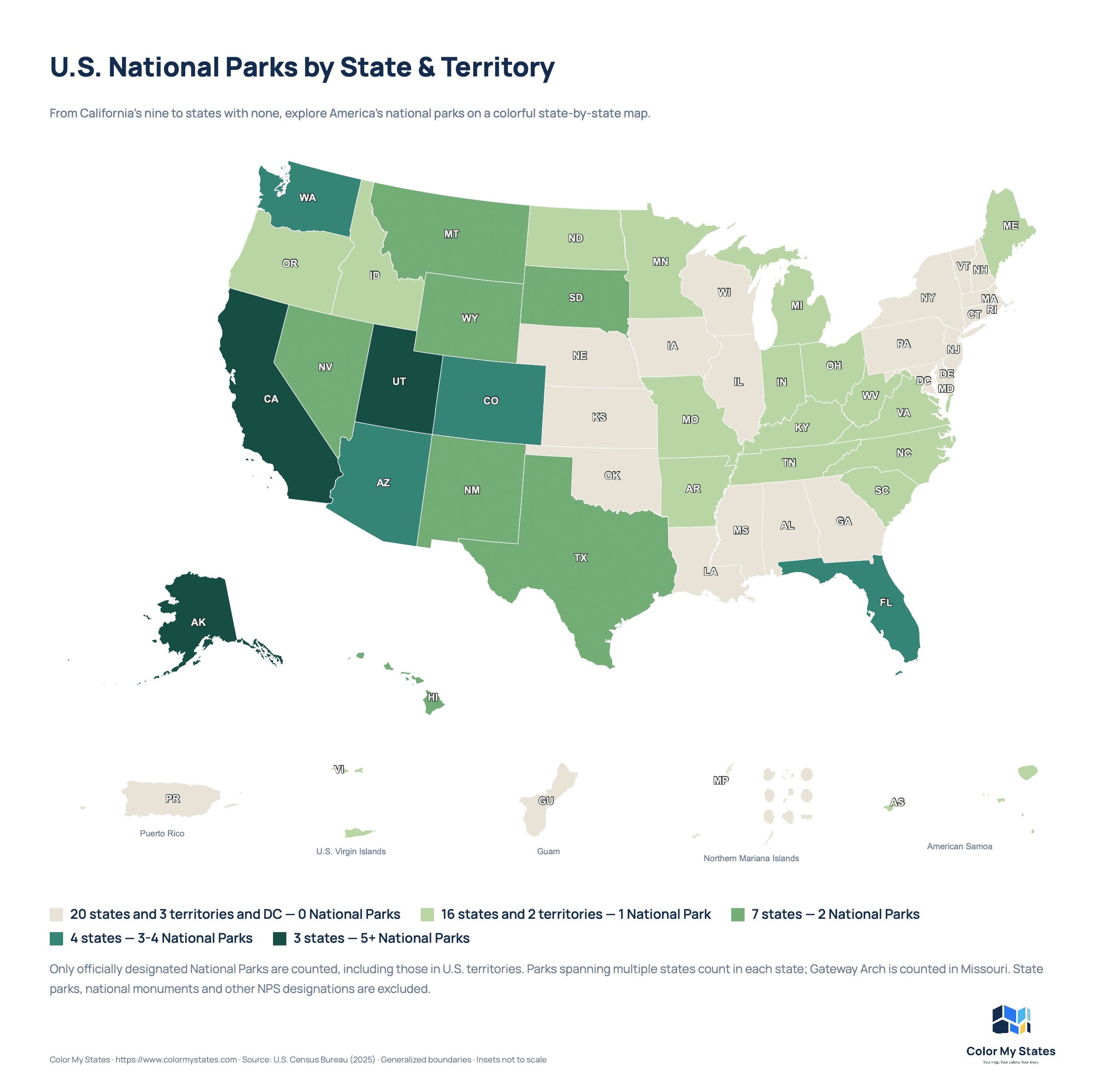
The map groups states and territories into five categories: 0, 1, 2, 3–4 and 5 or more national parks. The colors progress from light sand to deep green, with darker shades representing higher counts.
Arizona remains in the 3–4 category following Chiricahua’s redesignation, so its map color stays the same.
The shading shows how many parks a place contains. It does not indicate their size, popularity or how rewarding a visit might be.
A zero means there is no park with the formal National Park designation under this map’s counting method. State parks, national monuments and other protected or historic sites are outside its scope.
Why some parks count in more than one state
Park boundaries do not always follow state lines. Yellowstone counts in Wyoming, Montana and Idaho; Death Valley counts in California and Nevada; and Great Smoky Mountains counts in North Carolina and Tennessee.
Because shared parks appear in each relevant state’s total, adding all the numbers together produces more than 64. The nationwide total counts each park only once.
Create a map of your own park travels
This overview was created with Color My States, where you can color U.S. states and territories, add a legend and download your map.
You could also make a personal version showing states where you have visited a national park, places you hope to explore next or destinations from a previous trip. Give each color a clear meaning and let the map tell your own travel story.
Whether your next journey includes one park or several, start with the places you want to experience and give yourself time to enjoy them.
Sources and map notes
Counts updated October 21, 2026, using the National Park Service’s National Park System list and its October 20 announcement of Chiricahua’s redesignation. This article includes Chiricahua National Park in the nationwide total of 64 and Arizona’s total of four. Only officially designated National Parks are included. Parks crossing state boundaries count in each state.
For this map, Gateway Arch is counted in Missouri, matching its individual NPS park website. The general NPS system list also associates it with Illinois.
Destination information: Chiricahua, Yosemite, Gates of the Arctic, National Park of American Samoa and Virgin Islands National Park. Check the relevant park website for current conditions and visit requirements. Park designations and totals may change over time.