Chiricahua National Park became America’s 64th national park on October 20, 2026. The former Chiricahua National Monument in southeastern Arizona received its new designation when President Donald Trump signed the Chiricahua National Park Act into law. For anyone working through a national park bucket list, there is now another name to add.
The headline is new, but the attraction has been here for millions of years: slender volcanic rock towers, enormous balanced boulders and trails that wind through a landscape of stone. A visit can be as simple as a scenic drive and a short walk, or as active as a full day exploring the canyons on foot.
Information checked October 21, 2026. Some National Park Service pages still use “Chiricahua National Monument” while the new designation is being reflected online.
Contents
- Chiricahua added to our Interactive Map and National Parks Passport
- Is Chiricahua officially the 64th national park?
- Where is Chiricahua National Park?
- What makes Chiricahua’s rock formations special?
- Things to do in Chiricahua National Park
- Camping at Bonita Canyon Campground
- Best time to visit Chiricahua National Park
- A suggested one-day Chiricahua itinerary
- Chiricahua National Park FAQ
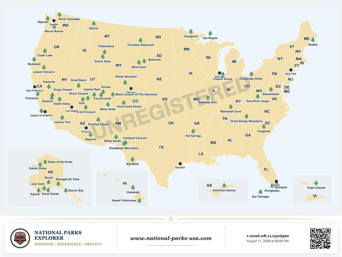
Chiricahua added to our Interactive Map and National Parks Passport
Our Interactive Map has been updated to include Chiricahua National Park. Explore its location alongside the other national parks, or visit our Chiricahua National Park page to start planning your visit.
Chiricahua is also available on your Personal Map and in the National Parks Passport. Add it to your Bucket List or record when you visited. The Passport now includes 64 national parks, with your existing visits preserved.
Is Chiricahua officially the 64th national park?
Yes. The White House announcement dated October 20, 2026 confirms that H.R. 6380 redesignates Chiricahua National Monument as Chiricahua National Park.
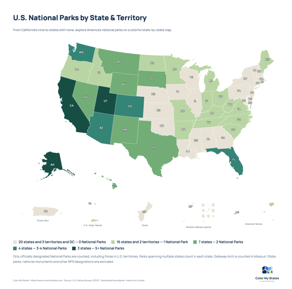
Previously protected as a national monument since 1924, Chiricahua joins Grand Canyon, Petrified Forest and Saguaro as Arizona’s fourth national park. The change gives an existing protected landscape a new designation; visitors who knew it as a monument will recognize the same destination.
Where is Chiricahua National Park?
Chiricahua is in Cochise County in southeastern Arizona, near Willcox. The usual paved approach from Interstate 10 goes through Willcox, following Arizona Highway 186 and then Highway 181 toward the park.
Plan this as a deliberate stop, with fuel, food and offline maps sorted out before the final stretch. Cell reception is limited, and the park’s paved road ends at Massai Point: it is not a through-route across the mountains. Check the official NPS directions rather than accepting an unfamiliar dirt-road shortcut from your navigation app.
What makes Chiricahua’s rock formations special?
Chiricahua’s defining features are its rhyolite pinnacles. Their story begins with a major volcanic eruption roughly 27 million years ago. Ash and volcanic debris accumulated and hardened into rhyolite tuff, which later fractured and eroded into the pillars visible today.
Seen from an overlook, the formations create a layered landscape of ridges and spires. On a trail, their scale becomes much more apparent: individual towers and balanced rocks rise beside the walking route. The NPS geology overview explains how these formations developed.
Things to do in Chiricahua National Park
Drive to Massai Point
Bonita Canyon Drive provides an introduction to the park, with access to viewpoints and trailheads along the way. Massai Point is a useful destination for visitors who want to see the rock landscape without committing to a long hike. Build in time to stop and look, rather than treating the drive as transport to a single attraction.
Choose a hike that fits your day
For a first visit, consider these three options from the NPS hiking guide:
- Massai Point Nature Trail: a 0.5-mile loop for a short introduction to the scenery.
- Echo Canyon Loop: a 3.3-mile route with approximately 560 feet of elevation change, for visitors wanting a longer walk among the formations.
- Sugarloaf Peak: a 1.8-mile round-trip hike with approximately 500 feet of elevation gain.
Distance alone does not determine how a trail will feel. Elevation, sun exposure and footing matter too. Carry water, food and suitable layers, and check current trail conditions before setting out. Choose a route that returns you to your vehicle unless you have confirmed other transportation.
Photograph the rock landscape
A useful approach is to combine broad views with tighter compositions. Start with an overlook to show the scale of the landscape, then look for individual rock shapes along your chosen trail. Side lighting can help separate overlapping pillars, while a person on an established path can provide a sense of scale. Leave enough time to return safely if you stay for late-day light.
Make time for the night sky
Chiricahua earned International Dark Sky Park certification in 2021. If you are staying overnight, consider adding stargazing to your plans. Choose a clear night, check the moon phase and give your eyes time to adjust. The DarkSky International listing provides background on the designation.
Camping at Bonita Canyon Campground
Bonita Canyon Campground is the park’s developed campground. It offers a way to spend more time in the area without driving back to town after your visit. Reservations and individual campsite details are available through Recreation.gov, linked from the NPS campground page.
Read the dimensions for the specific site before booking. Many sites are small, and an available campsite does not automatically accommodate your vehicle or trailer. Road restrictions matter as well: NPS currently states that vehicles longer than 24 feet are not allowed beyond the campground.
For a camping trip, confirm your reservation, vehicle fit, current fire restrictions and food-storage requirements before arrival. Campground availability should be checked separately from park access.
Best time to visit Chiricahua National Park
For hiking, spring and fall are sensible starting points when choosing dates, based on the park’s seasonal temperatures. October and April, for example, generally offer milder daytime conditions than early summer. This is a planning recommendation, not a guarantee of comfortable weather.
Chiricahua is a mountain destination, with elevations ranging from about 5,124 feet at the entrance to 7,310 feet on Sugarloaf Mountain. Conditions can differ considerably from lower-elevation Arizona cities.
- Spring: prepare for cool mornings and changing conditions.
- Summer: account for heat, thunderstorms, lightning and potential flash flooding.
- Fall: bring layers for cooler mornings and evenings.
- Winter: snow and ice may affect roads and hiking plans.
Use the NPS weather information and a current forecast to make the final decision.
A suggested one-day Chiricahua itinerary
For a first visit, we suggest keeping the day focused on one main hike and the scenic drive:
- Start with conditions: check park alerts and stop at the visitor center when open.
- Choose your main walk: consider Echo Canyon Loop if its distance and elevation suit your group, or choose a shorter option.
- Allow time for lunch: bring your own food so your schedule does not depend on returning to town.
- Visit Massai Point: enjoy the overlook and add the nature trail if time and energy allow.
- Keep a buffer: leave room for photography stops, weather changes and the drive out.
This is a suggested itinerary, not an official route or a promise that every stop will be accessible. If hiking is your main interest, an overnight stay gives you more flexibility to split your walks across two days.
Chiricahua National Park FAQ
What is the newest national park in the United States?
As of October 21, 2026, it is Chiricahua National Park in Arizona. Its designation on October 20 brought the total to 64 national parks.
Is Chiricahua National Monument the same place?
Yes. Chiricahua National Park is the former Chiricahua National Monument. Older maps, travel articles and some official pages still use the previous name.
Is there an entrance fee?
As checked on October 21, 2026, the NPS fees page, still under the monument name, lists no entrance or parking fee. Camping is separate. Recheck the official information before your trip.
Can you visit without a long hike?
Yes. The scenic drive and Massai Point make it possible to plan a visit around overlooks and shorter walks. Check accessibility information for specific stops if you need step-free access.
How many national parks does Arizona have now?
Arizona now has four: Grand Canyon, Petrified Forest, Saguaro and Chiricahua.
Whether this is your first Arizona park or the next stop on a national park checklist, plan time to explore beyond the new name. Chiricahua’s appeal is in the details: a narrow gap between pillars, the shape of a balanced boulder and the changing view as you walk through the rocks.
Designation background: Senator Mark Kelly’s October 20 announcement. Visitor information: National Park Service. Check official alerts, road conditions and reservation details before traveling.